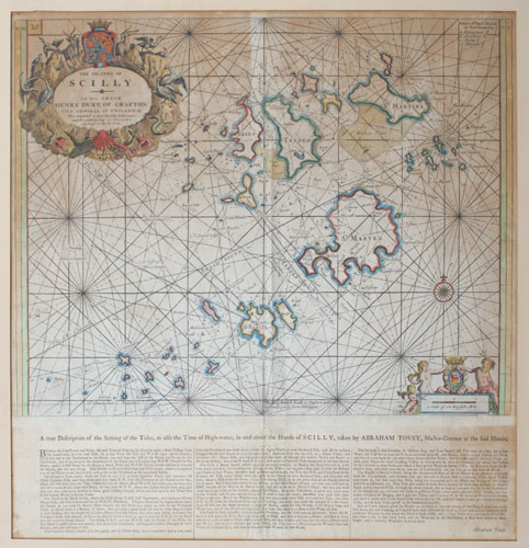
The Islands of Scilly.
[after Captain Greenvile Collins.] [London: Mount & Page, c.1770.] Engraved sea chart with hand colour. 455 x 570mm (18 x 22½"), with scarce extra letterpress pasted underneath. Some staining and toning. A detailed chart of the Scilly Islands, published in the first sea atlas of the British Isles, first issued in 1693. This example has extra letterpress, 'A true Description of the Setting of the Tides... taken by Abraham Tovey, Master Gunner at the said Islands', pasted underneath, meaning the map had to be folded twice to fit in the volume. In it Tovey writes 'mind Dhese directions, and Captain Collin's Draught of these Islands, and you will come in safe. Tovey (1687-1759) was responsible for maintaining the defences of the Scillys for many years.
[Ref: 57722] £850.00