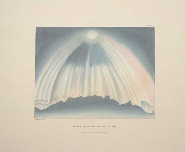
Aurora Borealis, seen Oct.r 24th 1847. Plate IX.
J. Andrews Zincog. Printed by Chabet, Skinner Street, Snow Hill.
[Cambridge: Macmillan, Barclay, and Macmillan, London: G. Bell, Fleet Street, n.d., c.1848.]
Coloured zincograph. Printed area 160 x 175mm (6¼ x 7"), with very large margins.
A view of the Aurora Borealis seen from Cambridge. Plate IX of ''An account of the Aurora Borealis, seen near Cambridge, October the 24th, 1847'' by John H. Morgan and John T. Barber, a record of a sighting unusually far south.
[Ref: 56850] £160.00
(£192.00 incl.VAT)

Aurora Borealis, seen at the Cambridge Observatory. September 21.st 1846. Plate. XI
J. Andrews Zincog. Printed by Chabet, Skinner Street, Snow Hill.
[Cambridge: Macmillan, Barclay, and Macmillan, London: G. Bell, Fleet Street, n.d., c.1848.]
Coloured zincograph. Printed area 160 x 175mm (6¼ x 7"), with very large margins. Some time staining.
One a set of twelve coloured engravings from "An account of the Aurora Borealis, seen near Cambridge, October the 24th, 1847: together with those of September 21, 1846, and March 19, 1847, seen at the Cambridge Observatory" by John H. Morgan and John T. Barber. Cambridge: Macmillan, Barclay, and Macmillan, London: G. Bell, Fleet Street.
[Ref: 56941] £140.00
(£168.00 incl.VAT)
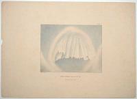
Aurora Borealis, seen Oct.r 24.th 1847. Plate. V.
J. Andrews Zincog. Printed by Chabet, Skinner Street, Snow Hill.
[Cambridge: Macmillan, Barclay, and Macmillan, London: G. Bell, Fleet Street, n.d., c.1848.]
Coloured zincograph. Printed area 160 x 175mm (6¼ x 7"), with very large margins. Some time staining.
One a set of twelve coloured engravings from "An account of the Aurora Borealis, seen near Cambridge, October the 24th, 1847: together with those of September 21, 1846, and March 19, 1847, seen at the Cambridge Observatory" by John H. Morgan and John T. Barber. Cambridge: Macmillan, Barclay, and Macmillan, London: G. Bell, Fleet Street.
[Ref: 56942] £180.00
(£216.00 incl.VAT)
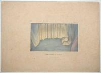
Aurora Borealis, seen Oct.r 24.th 1847. Plate. VI.
J. Andrews Zincog. Printed by Chabet, Skinner Street, Snow Hill.
[Cambridge: Macmillan, Barclay, and Macmillan, London: G. Bell, Fleet Street, n.d., c.1848.]
Coloured zincograph. Printed area 160 x 175mm (6¼ x 7"), with very large margins. Some time staining.
One a set of twelve coloured engravings from "An account of the Aurora Borealis, seen near Cambridge, October the 24th, 1847: together with those of September 21, 1846, and March 19, 1847, seen at the Cambridge Observatory" by John H. Morgan and John T. Barber. Cambridge: Macmillan, Barclay, and Macmillan, London: G. Bell, Fleet Street.
[Ref: 56943] £140.00
(£168.00 incl.VAT)
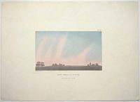
Aurora Borealis, seen Oct.r 24th 1847. Plate I.
J. Andrews Zincog. Printed by Chabet, Skinner Street, Snow Hill.
[Cambridge: Macmillan, Barclay, and Macmillan, London: G. Bell, Fleet Street, n.d., c.1848.]
Coloured zincograph. Printed area 160 x 175mm (6¼ x 7"), with very large margins.
A view of the Aurora Borealis seen from Cambridge. Plate IV of ''An account of the Aurora Borealis, seen near Cambridge, October the 24th, 1847'' by John H. Morgan and John T. Barber, a record of a sighting unusually far south.
[Ref: 57011] £140.00
(£168.00 incl.VAT)
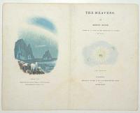
The Heavens. By Robert Mudie. [with two vignettes] The Seasons. Polar Sky.
Baxter's Patent Oil Colour Printing, 3 Charter-house Square. From a painting by W. Westall, A.R.A.
London: Thomas Ward & Co., Paternoster Row. MDCCCXXXV [1835].
Fine Baxter-printed titlepage and frontispiece. Sheet 165 x 210mm (6½ x 8¼"). A little faint staining.
The two illustrations are of the Aurora Borealis, with two polar bears and a comet, and the sun with three Earths orbiting.
[Ref: 57024] £130.00
(£156.00 incl.VAT)
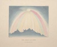
Aurora Borealis, seen Oct.r 24th 1847. Plate VIII.
J. Andrews Zincog. Printed by Chabet, Skinner Street, Snow Hill.
[Cambridge: Macmillan, Barclay, and Macmillan, London: G. Bell, Fleet Street, n.d., c.1848.]
Coloured zincograph. Printed area 160 x 175mm (6¼ x 7"), with very large margins.
A view of the Aurora Borealis seen from Cambridge. Plate VIII of ''An account of the Aurora Borealis, seen near Cambridge, October the 24th, 1847'' by John H. Morgan and John T. Barber, a record of a sighting unusually far south.
[Ref: 56847] £160.00
(£192.00 incl.VAT)
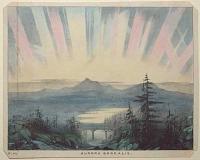
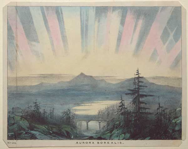
Aurora Borealis
[London: David Bogue, c. 1845.]
Coloured lithograph on card. Sheet 150 x 190mm (6 x 7½"). Plate cut and rejoined, tear in inscription area, edges chipped.
The Northern Lights. Plate 94 of 'The Beauty of the Heavens: a pictorial display of the astronomical phenomena of the universe' by Charles F Blunt.
[Ref: 56792] £95.00
(£114.00 incl.VAT)
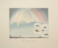
Aurora Borealis, seen Oct.r 24th 1847. Plate X.
J. Andrews Zincog. Printed by Chabet, Skinner Street, Snow Hill.
[Cambridge: Macmillan, Barclay, and Macmillan, London: G. Bell, Fleet Street, n.d., c.1848.]
Coloured zincograph. Printed area 160 x 175mm (6¼ x 7"), with very large margins.
A view of the Aurora Borealis with the silhouettes of two churches. Plate X of ''An account of the Aurora Borealis, seen near Cambridge, October the 24th, 1847'' by John H. Morgan and John T. Barber, a record of a sighting unusually far south.
[Ref: 56848] £160.00
(£192.00 incl.VAT)
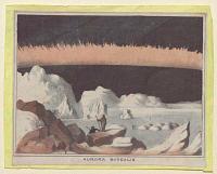
Aurora Borealis.
[n.d., c.1840.]
Coloured lithograph. Sheet 95 x 115mm (3¾ x 4½"). Trimmed and laid on album paper.
A view of the Aurora Borealis over an icy landscape.
[Ref: 56864] £120.00
(£144.00 incl.VAT)
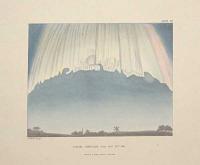
Aurora Borealis, seen Oct.r 24th 1847. Plate VII.
J. Andrews Zincog. Printed by Chabet, Skinner Street, Snow Hill.
[Cambridge: Macmillan, Barclay, and Macmillan, London: G. Bell, Fleet Street, n.d., c.1848.]
Coloured zincograph. Printed area 160 x 175mm (6¼ x 7"), with very large margins.
A view of the Aurora Borealis with the silhouettes of a windmill and a church steeple. Plate VII of ''An account of the Aurora Borealis, seen near Cambridge, October the 24th, 1847'' by John H. Morgan and John T. Barber, a record of a sighting unusually far south.
[Ref: 56846] £160.00
(£192.00 incl.VAT)
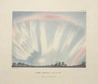
Aurora Borealis, seen Oct.r 24th 1847. Plate II.
J. Andrews Zincog. Printed by Chabet, Skinner Street, Snow Hill.
[Cambridge: Macmillan, Barclay, and Macmillan, London: G. Bell, Fleet Street, n.d., c.1848.]
Coloured zincograph. Printed area 160 x 175mm (6¼ x 7"), with very large margins.
A view of the Aurora Borealis seen from Cambridge. Plate II of ''An account of the Aurora Borealis, seen near Cambridge, October the 24th, 1847'' by John H. Morgan and John T. Barber, a record of a sighting unusually far south.
[Ref: 56855] £160.00
(£192.00 incl.VAT)
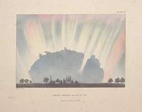
Aurora Borealis, seen Oct.r 24th 1847. Plate IV.
J. Andrews Zincog. Printed by Chabet, Skinner Street, Snow Hill.
[Cambridge: Macmillan, Barclay, and Macmillan, London: G. Bell, Fleet Street, n.d., c.1848.]
Coloured zincograph. Printed area 160 x 175mm (6¼ x 7"), with very large margins.
A view of the Aurora Borealis seen from Cambridge, with a church spire. Plate IV of ''An account of the Aurora Borealis, seen near Cambridge, October the 24th, 1847'' by John H. Morgan and John T. Barber, a record of a sighting unusually far south.
[Ref: 56856] £160.00
(£192.00 incl.VAT)
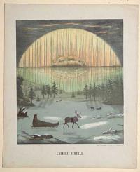
L'Aurore Boreale.
Lith. E. Lemaitre, Rue brulée 6, à Strasbourg.
[Strasbourg: Libraire Derivaux, 1856.]
Chromolithograph, with gum arabic highlights. Sheet 290 x 235mm (9¼"), very large margins.
A view of the Aurora Borealis in Lapland, with sledges drawn by reindeer. From Munerelle’s 'Les Phenomenes et Curiosites de la Nature'.
[Ref: 56845] £130.00
(£156.00 incl.VAT)
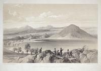
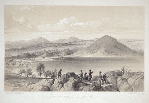
Lake of Aushkul and Holy Mount.
R. Murchison Esq.re del. L. Haghe lith. Day & Haghe Lith.rs to the Queen.
[London: John Murray, 1845.]
Rare tinted lithograph. Sheet 195 x 255mm (7¾ x 10"). With two registry pin holes in corners, as usual with this technique.
Aushkul Lake and mountain in the Urals, famed for its jasper, vases of which decorate the Hermitage staircase. The plate comes from Sir Roderick Impey's important monograph, 'The Geology of Russia in Europe and the Ural Mountains', the result of an expedition he made accompanied by Édouard de Verneuil (1805-73) and Count Alexander von Keyserling (1815-91). The expedition led to him describing the Permian geologic period, named after the Perm region of Russia, the last period of the Paleozoic era. Not in Abbey.
[Ref: 52674] £140.00
(£168.00 incl.VAT)
![[32 original pencil sketches by Winifred Austen, drawn for] A Book of Dogs](img-thumbnail/jpegs/60126.jpg)
[32 original pencil sketches by Winifred Austen, drawn for] A Book of Dogs Being a Discourse on them, with Many Tales and Wonders Gathered by E. Nesbit, and Original Pencil Drawing by Winifred Austen.
London: J.M. Dent & Co., 1898.
Oblong 8vo (170 x 240mm, 6¾ x 9½"), illustrated cloth; pp. (iv)+60, photogravure frontispiece, offset-lithographic text illustrations throughout. WITH 32 original pencil sketches on 27 cards, largest 240 x 300mm (9½ x 11¾"). WITH ink a.l.s. signed by Austen. Three images have foxing.
A collection of pencil sketches by Winifred Austen (1876– 1964) drawn to illustrate 'A Book of Dogs', including one not used. The signed letter, dated 23rd February 1904, was to accompany 28 cards sent by Austen to William H. Ward, who had engraved and printed the book six years earlier, with a typed list on the second page. Of the 28, one ('Tatters') is marked in pencil 'To Helen Hofer' and is not present here. Ward initialed the letter as confirmation of receipt two days later. Among the breeds illustrated are a bulldog, pug, Irish terrier, dingo, Schipperke and dingo. Winifred Austen (1876-1964) was a painter and engraver known for her pictures of animals and birds, publishing individual plates and illustrating several books.
[Ref: 60126] £5,000.00
view all images for this item
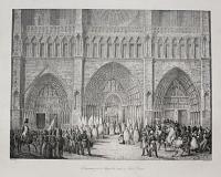
Drapeaux pris à Austerlitz recus à Notre-Dame.
V. Adam del. Litho: de C. Motte.
[n.d. c.1826.]
Lithograph with very large margins. Printed area 305 x 380mm (12 x 15").
In the Battle of Austerlitz (2nd December 1805) Napoleon crushed the Third Coalition and effectively destroyed the Holy Roman Empire. As part of the victory celebrations (which included the commissioning of the Arc de Triomphe) fifty captured regimental colours were paraded at Notre Dame Cathedral. Published in A.V. Arnault's 'Vie politique et militaire de Napoléon', Paris, 1822-1826.
[Ref: 35926] £120.00
(£144.00 incl.VAT)
![[Music Sheet] Musical Bouquet. The Battle of Austerlitz Quadrille.](img-thumbnail/jpegs/55742.jpg)
[Music Sheet] Musical Bouquet. The Battle of Austerlitz Quadrille. Composed by A. Le Duc.
London: Musical Bouquet Office, 192, High Holborn: & J. Allen, 20 Warwick Lane, Paternoster Row.
4pp. lithographed music, with vignette scene on front. Sheets 340 x 250mm (13¼ x 9¾"). Paper toned, second sheet of music with long tear sellotaped.
The vignette shows Napoleon and his officers at the Battle of Austerlitz (2nd December 1805), after the painting by François Gérard.
[Ref: 55742] £70.00
(£84.00 incl.VAT)
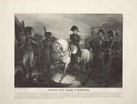
Encore une Croix d'Honneur...
a Paris chez Dopter, rue St Jacques, No 21 [n.d., c.1830].
Mezzotint. 235 x 315mm (9¼ x 12½"), with large margins.
After the Battle of Auterliz, Napoleon sits on his white horse, awarding the Croix d'Honneur for bravery.
[Ref: 55816] £95.00
(£114.00 incl.VAT)
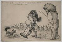
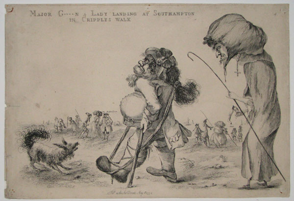
Major G****n & Lady landing at Southampton in Cripples walk
[William Austin]
Pubd as the Act Directs May 1st 1773
Rare engraving, 270 x 375mm. 10½ x 14½".
Scene at Southampton, with the Isle of Wight faintly visible in the background. In the foreground a man stands with crutches to support his gouty foot is followed by a woman carrying a bottle labelled 'Hartshorn'. Nearer the shore are several figures, one of whom is labelled 'The Rabbit Doctor', and who carries a large rabbit under his arm. 'This is St. André (1680-1776), an unqualified but fashionable surgeon who investigated the case of Mary Tofts in 1726, who professed to be delivered of rabbits [...] He vouched for her story in all its impossible details. In spite of the scandal caused by its exposure he eloped with, and afterwards married, Lady Elizabeth Molyneux on the night of the death of her husband whom he had been professionally attending. They settled in Southampton about 1750' (Stevens and George). This episode was also depicted by William Hogarth in his engraving 'Cunicularii, or the Wise Men of Goodliman in Consultation'. Engraved by William Austin (1721-1820). BM Satire 5115.
[Ref: 18916] £290.00
(£348.00 incl.VAT)
![[Sarah Austin] Mrs Austin.](img-thumbnail/jpegs/48445.jpg)
[Sarah Austin] Mrs Austin.
Painted by H.P. Taylor, R.A. _ Drawn on Stone by Weld Taylor.
Published by Weld Taylor, 15 G.t Portland St Aug.st 1835.
Lithograph on chine collé, backing paper printed with title. Printed area 370 x 280mm (14½ x 11"). Tears in backing paper.
Sarah Austin (née Taylor) (1793-1867), translator of of German literature and editor of the 'Memoirs of Sydney Smith' (1855) and 'Letters from Egypt' (1865) by Lady Duff-Gordon (Austin's own daughter, Lucie). Her husband, John Austin (1790-1859), was an influential writer on law, especially with his ' The Province of Jurisprudence Determined' (1832). The couple were good friends with both Jeremy Bentham and John Stuart Mill.
[Ref: 48445] £75.00
(£90.00 incl.VAT)
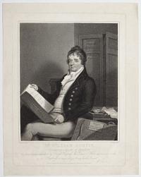
M.r William Austin, Drawing Master of Brighton. This Print is humbly dedicated to his Royal Highness the Prince of Wales with every mark of respect by his Highnesses much obliged & very humble Servant. W. Austin.
Edm.d Scott del.t. Ja.s Godby sculp.t.
Published as the Act directs March 25 1809 by W. Austin, No.20, Great Russell Street Brighton.
A fine stipple. Plate: 215 x 290mm (8½ x 11½"), very large margins. Dusty.
A seated portrait of drawing master and caricaturist William Austin (1721-1820). A pupil of George Bickham, Austin worked first as an artist and then as a drawing master in Brighton, he also owned a print shop which sold caricatures many of which supported Charles James Fox. Austin is shown holding a folio titled 'Patriotic Elections, Westminster, Middlesex, Surrey and Bedford' while a portfolio labelled 'Portraits of Mr Fox and other illustrious Characters' leans up against a table.
[Ref: 44589] £190.00
(£228.00 incl.VAT)
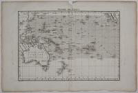
Théorie des Vents.
Gravé par Berthe.
[Paris: veuve Agasse, 1828.]
Engraved map. 265 x 375mm, 10½ x 14¾". Centre fold split and taped.
Map of Australasia and the South Pacific to California, marking the directions of the winds. Published in Bory de Saint-Vincent & Desmarest's 'Atlas encyclopedique contenant les cartes et les planches relatives a la geographie physique'.
[Ref: 25745] £120.00
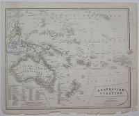
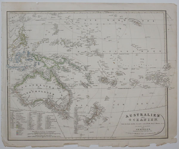
Australien oder Oceanien...
von A.H. Köhler, Oberlieutnant in Königl. Sachs, Jughen. Corps.
Leipsig, J.C. Hinrichs'sche Buch_und Landkärtenhandlung 1849.
Engraved map with hand colour. 410 x 500mm, 16 x 19¾". Tear in bottom printed border, tatty margins.
Map of Australasia marking the European colonies.
[Ref: 25747] £160.00
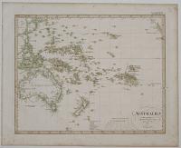
Australien nach Krusenstern u. A. in Mercators Projection entworfen u. ges. v. Ad. St., 1826. Nachträge bis 1835.
I. Thiel sculp.
Engraved map with hand colour. 340 x 400mm, 13½ x 15¾". Slight creasing & foxing.
A German map of Australasia.
[Ref: 25749] £120.00
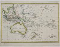
Océeanie. par J.B. Poirson.
Gravé par Thierry, Rue des Mathurins, S. Jacques, No. 1.
[Paris c.1830.]
Engraved map, coloured. 230 x 335mm, 9 x 13¼". Narrow lateral margins.
A map of Australasia showing north to Hawaii and Taiwan, published in the 'Traite Eleméntaire de Géographie'.
[Ref: 25752] £160.00
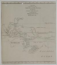
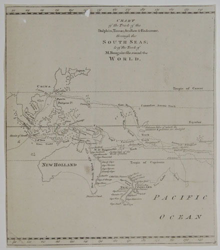
Chart of the Track of the Dolphin, Tamar, Swallow & Endeavour, through the South Seas; & the Track of M. Bougainville, round the World.
[Engraved by Thomas Bowen.]
[London: London Magazine, 1773.
Engraved map. Sheet 260 x 230mm, 13¼ x 9". Two holes, trimmed close, binding folds.
A map of the South Pacific showing the routes of the 18th century explorers including Cook on his First Voyage, in which he mapped New Zeland and the east coast of Australia for the first time. This is one sheet of a three-sheet map: however, as the sheets were published in seperate months in the Gentleman's Magazine, they often appear separately.
[Ref: 25753] £160.00
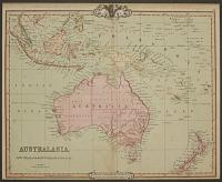
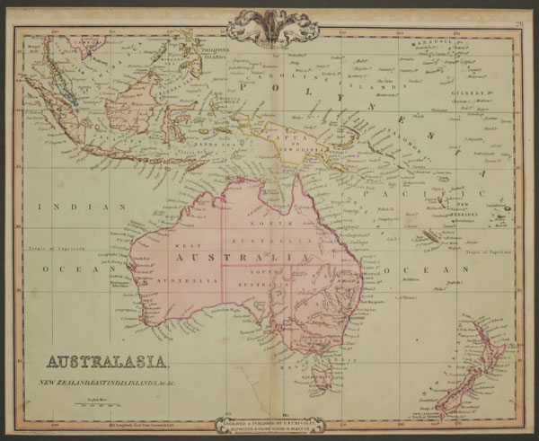
Australasia, New Zealand, East India Islands, &c. &c.
Engraved and Published by G.F. Cruchley, Map Seller and Globe Maker, 81 Fleet Street. April 1st 1842. Additions to 1854.
Engraved map with original hand colour. 370 x 450mm, 14½ x 17¾". Repaired tear.
A map of Australasia, showing Australia and New Zealand, Indonesia, New Caledonia and Fiji.
[Ref: 25658] £180.00
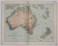
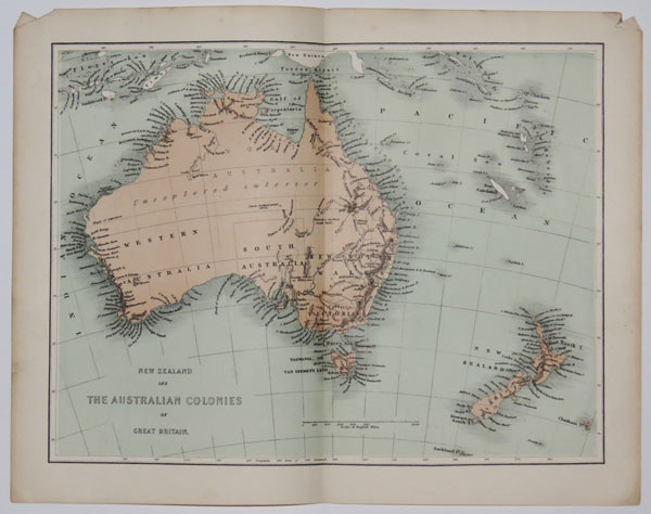
New Zealand and the Australian colonies of Great Britain.
[Virtue & Co., n.d., c.1855.]
Tinted lithographic map. Printed area 230 x 305mm, 9 x 12".
Australia & New Zealand, with much of the Australian interior marked 'unexplored', although the extents of the treks of Sturt (1845) and Kennedy (1847) are shown.
[Ref: 26309] £65.00
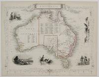
Australia.
The Illustrations by by J.Marchant, & Engraved by J.B. Allen. The Map Drawn and engraved by J. Rapkin.
John Tallis & Company, London & New York. [n.d., c.1855.]
Steel engraved map with outline colour. Sheet 270 x 360mm, 10½ x 14".
Map of Australia, with decorative vignettes of Sydney, kangaroos, parrots and cockatoos.
[Ref: 25660] £230.00
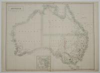
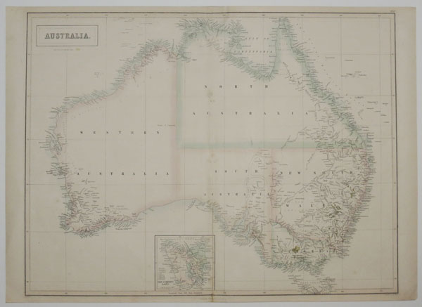
Australia.
J. Bartholomew Edin.r.
Edinburgh, Published by A. & C. Black. [n.d, c.1850.]
Coloured lithographic map. 420 x 545mm, 16½ x 21½". Slight hole near centre fold.
Large map of Australia published prior to the creation of Queensland in 1859.
[Ref: 25738] £220.00
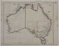
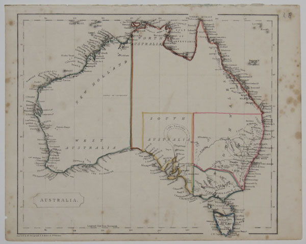
Australia.
Engraved by the omnigraph, F.P. Becker & Co. patentees.
[London : George Virtue, n.d., c.1840.]
Coloured lithographic map. 210 x 245mm, 8¼ x 9¾".
Map of Australia, with a dotted line marking the outline of Lake Torrens.
[Ref: 25740] £95.00

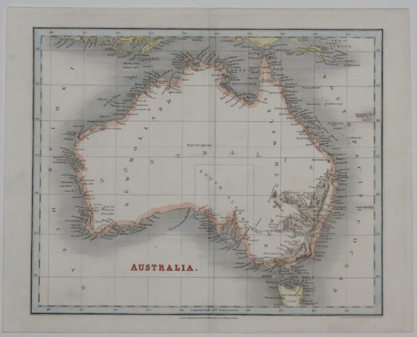
Australia and Islands Adjacent.
Engraved by S. Hall, Burry Street Bloomsbury.
London. Published by Longman & Co. Paternoster Row. c. 1840's
Coloured engraved map. 195 x 240mm, 7¾ x 9½".
Map of Australia, with southern Indonesia.
[Ref: 25741] £95.00
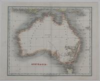
Australia.
Drawn and Engraved by J. Dower, Pentonville, London.
London. Published by Orr & Smith, Paternoster Row.
Coloured engraved map. 230 x 270mm, 9 x 10½".
Map of Australia.
[Ref: 25742] £120.00
![[The 1861 expedition of the Dempster Brothers, Clarkson & Harper in Western Australia, with map.]](img-thumbnail/jpegs/25655.jpg)
[The 1861 expedition of the Dempster Brothers, Clarkson & Harper in Western Australia, with map.] Mittheilungen aus Justus Perthes' Geographischer anstalt Über Wichtige Neue Erforschungen dem Gesammtgebiete der Geographie von Dr A. Petermann. 1863. III.
Gotha: Justus Perthes. Geschlossen am 14, März 1863.
Periodical, uncut, 4to, printed wrapprs; pp. 81 - 120, German text; a folding lithographic map with hand colour.
An issue of 'Communications from Justus Perthes' Geographical Institute', a German version of the Royal Geographical Society. It contains five monographs including: the Australian Expedition; Karl Klaus von der Decken survey of Kilimanjaro with Otto Kersten, reaching 14,000 feet before bad weather drove them back; and the German zoologist Hermann Burmeister's emigration to Buenos Aires. The rest of the pamphlet is various 'Geographical Notes' and a list of new publications. Perthes is best known as the publisher of Stieler's Hand-Atlas.
[Ref: 25655] £320.00
view all images for this item
![[The 1863 expedition into the interior of Western Australia by Henry Maxwell Lefroy, with map.]](img-thumbnail/jpegs/25657.jpg)
[The 1863 expedition into the interior of Western Australia by Henry Maxwell Lefroy, with map.] Mittheilungen aus Justus Perthes' Geographischer anstalt Über Wichtige Neue Erforschungen dem Gesammtgebiete der Geographie von Dr A. Petermann. 1864. VIII.
Gotha: Justus Perthes. Geschlossen am 25 August 1864.
Periodical, 4to, printed wrappers; pp. 281 - 320, German text; a folding lithographic map with hand colour.
An issue of 'Communications from Justus Perthes' Geographical Institute', a German version of the Royal Geographical Society. It contains five monographs including Lefroy's expedition into Western Australia east of Perth. The rest of the pamphlet is various 'Geographical Notes' and a list of new publications. Perthes is best known as the publisher of Stieler's Hand-Atlas.
[Ref: 25657] £250.00
view all images for this item

Australia in 1839.
J. & C. Walker Sculp.t.
Published by the Society for the Diffusion of Useful Knowledge, 59 Lincolns Inn Fields Feb.y 1st 1840.
Engraved map with outline colour. Sheet 340 x 410mm, 13½ x 16".
Map of Australia, with a population table giving the total as 141,000, probably discounting aboriginals. The Society for the Diffusion of Useful Knowledge (or SDUK, from 1826-1848) published inexpensive scientific texts for the rapidly-expanding literate public.
[Ref: 25661] £190.00

Australia with the Latest Discoveries, Exhibiting The New Settlement, with the Adjacent Countries.
[London: William Darton?, c.1832.]
Scarce engraved map with hand colour. Sheet 300 x 400mm (11¾ x 15¾"). Bottom left corner restored, creases.
A map of Australia with the detail limited to around the coastline. See National Library of Australia Bib ID: 3536248 for an example with Darton's imprint.
[Ref: 67178] £280.00
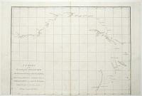
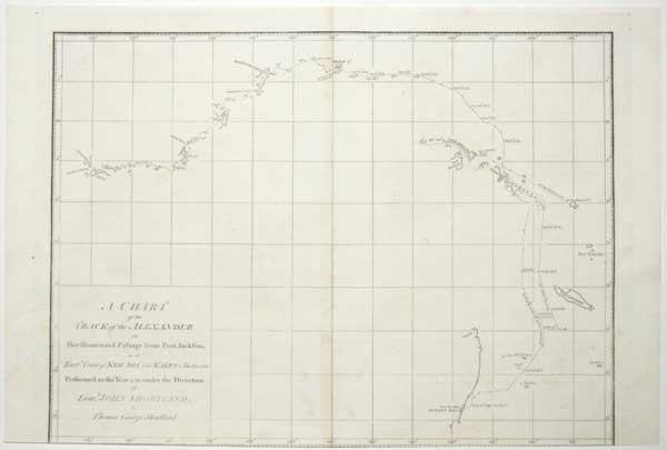
A Chart of the Track of the Alexander on Her Homeward Passage from Port Jackson on the East.n Coast of New South Wales to Batavia; Performed in the Year 1788 under the Direction of Lieut.t John Shortland.
by Thomas George.
[Publish'd as the Act directs by J. Stockdale August 24th 1789.]
Engraved map. 275 x 380mm (10¾ x 15"). Trimmed into printed border at bottom, losing publication line; holes in image filled.
A chart of the return route of the 'Alexander', one of the ships of the First Fleet. It was published in Arthur Phillips 'A Voyage to Botany Bay…'
[Ref: 61705] £220.00
![[Gum Tree] Vue d'un paysage Australien où figurent les Xanthorrhoea (sur l'arrière plan.)](img-thumbnail/jpegs/55362.jpg)
[Gum Tree] Vue d'un paysage Australien où figurent les Xanthorrhoea (sur l'arrière plan.) Off. Lith. & pict. in Horto Van Houtteano.
[Paris: A Gand, 1849.]
Lithograph. Sheet 165 x 245mm (6½ x 9½").
A shooting scene, with a gum tree. From van Houtte's 'Flore des serres et des jardins de l'Europe, ou Descriptions et figures des plantes les plus rares et les plus méritantes'.
[Ref: 55362] £60.00
(£72.00 incl.VAT)
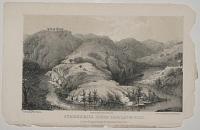
Summerhill Creek Near Langs Point.
On Stone by W.L. Walton. From a Sketch by Coll. Mundy. Printed by Hullmandel & Walton.
London: Richard Bentley, New Burlington Street, 1852.
Tinted lithograph, image 110 x 180mm. 4¼ x 7". Tatty and chipped extremities.
Summer Hill Creek, Ophir, New South Wales, Australia. Plate to Volume III of 'Our Antipodes', published in three vols. in 1852. National Library of Australia: 2175597. Abbey Travel: 562, 14.
[Ref: 10784] £45.00
(£54.00 incl.VAT)
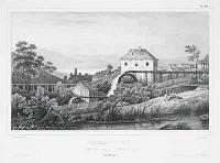
Moulins a Ble dans les environs d'Hobart-town. (Van-Diemen.)
de Sainson pinxt. Leborne Lith.
J. Tastu Editeur. Lith. de Bichebois aine, rue de la bibliotheque, 4. [Paris, 1833.]
Lithograph, sheet 340 x 510mm, 13½ x 20".
Original water mills with Hobart Town in the distance, from about half-way between present-day Gore and Wynyard Streets. The upper mill had steam power added in 1844 and became known as the Wilmot Mill. From 'Voyage de la Corvette l'Astrolabe', the account of Jules Dumont D'Urville's important expedition to the South Seas between 1826 and 1829. Numbered 'Pl.169' upper right.
[Ref: 13562] £290.00
(£348.00 incl.VAT)
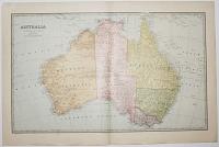
Australia.
Alex. J. Scalley Del.
The Picturesque Atlas Publishing Company, Limited, Sydney & Melbourne. Copyright 1888.
Colour-printed wood engraving (chromoxylograph). Printed area 370 x 610mm (14½ x 24"). Centre fold as issued. Very large margins.
A map of Australia, with the Northern Territory still marked as part of South Australia. It was published in the 'Picturesque Atlas of Australasia, a periodical issued between 1886-88, timed for the celebration of the centenary of the arrival of the First Fleet in 1888. This was the largest publication project attempted in the Australian colonies, with 50,000 subscribers, roughly 1.3 of the population. Codell: Imperial Co-histories, p. 219-220.
[Ref: 39136] £130.00
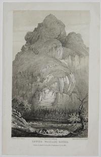
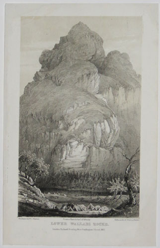
Lower Wallabi Rocks.
On Stone by W.L. Walton. From a Sketch by Coll. Mundy. Printed by Hullmandel & Walton.
London: Richard Bentley, New Burlington Street, 1852.
Tinted lithograph. Sheet: 140 x 220mm (5½ x 8½"). Repaired loss of top left and bottom right corner.
The dramatic rock formations at Wallabi point, New South Wales, Australia. Plate to Volume III of 'Our Antipodes', published in three vols. in 1852.
[Ref: 39865] £65.00
(£78.00 incl.VAT)
![[The 1861 expedition of Frank T. Gregory in north west Australia, with map.]](img-thumbnail/jpegs/25654.jpg)
[The 1861 expedition of Frank T. Gregory in north west Australia, with map.] Mittheilungen aus Justus Perthes' Geographischer anstalt Über Wichtige Neue Erforschungen dem Gesammtgebiete der Geographie von Dr A. Petermann. 1862. VIII.
Gotha: Justus Perthes. Geschlossen am 9, August 1862.
Periodical, 4to, printed wrapprs; pp. 281 - 320, German text; a wood-engraved text illustration & lithographic map with hand colour. Spine worn, ink stamp on cover and first page.
An issue of 'Communications from Justus Perthes' Geographical Institute', a German version of the Royal Geographical Society. It contains two monographs: the account of Francis Thomas Gregory's expedition to De Witt Land in Western Australia, 1861, finding excellent grazing land, illustrated with a map; and Theodor Kotschy's botanical expedition to Cyprus and Turkey in 1859, illustrated with a view of Larnaca. The rest of the pamphlet is various 'Geographical Notes' and a list of new publications. Perthes is best known as the publisher of Stieler's Hand-Atlas.
[Ref: 25654] £280.00
view all images for this item
![[Photograph of Australian Drawing.]](img-thumbnail/jpegs/41679.jpg)
[Photograph of Australian Drawing.]
Edward Farndell, Photographer, (from Kent Town.) N.o 83 Hindley Street, Adelaide, Late Professsor Halls.
Photograph, c. 1860's, with manuscript on verso. 105 x 65mm, (4¼ x 2½")
A photograph of a drawing, the manuscript description on the verso states 'A sketch my father made (and had photographed when her came back to Adelaide) of a hut he built and lived in for months, somewhere in central Australia on the side of the hill X is the tiny figure of a black man & spear in hand- somewhere between 1865-1870'. Edward Farndell was born in London in 1837, he travelled to Adelaide in the James Jardine in 1859. He worked in Kent Town between 1865-66, he moved to Hindley Street in 1866. He died in 1874.
[Ref: 41679] £650.00
view all images for this item
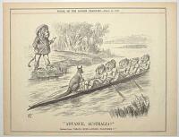
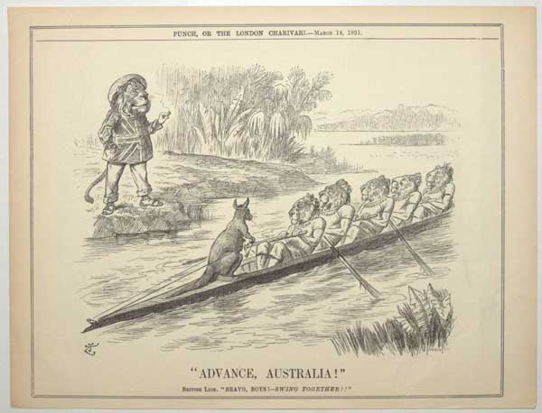
"Advance Australia" British Lion. "Bravo, Boys! - Swing Together!!"
[Monogram of Tenniel] Swain Sc.
Punch, Or The London Charivari. -March 14, 1891.
Wood Engraving, sheet 210 x 280mm (8¼ x 11"). Creased.
A rowing boat coxed by a kangaroo with a group of lions rowing. A lion, Mr. Leo Britannicus, wearing a union jack shirt coaches them from the shore. A satire on the Federation of Australia.
[Ref: 56010] £130.00
(£156.00 incl.VAT)
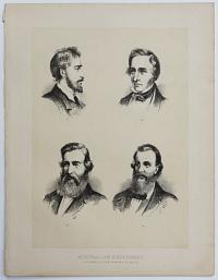
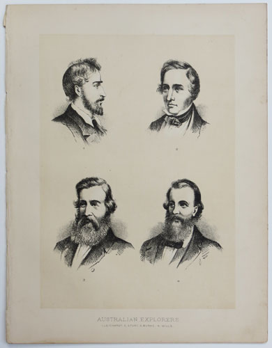
Australian Explorers 1, Leichardt. 2, Sturt. 3, Burke. 4, Wills.
[Anon., c.1880]
Chromolithograph, printed area 160 x 220mm (6¼ x 8½").
Portraits of: Ludwig Leichardt (1813-48), Charles Sturt (1795-1869), Robert O'Hara Burke (1821-61), and William John Wills (1834-61). From a book of Australian views.
[Ref: 44029] £65.00
(£78.00 incl.VAT)
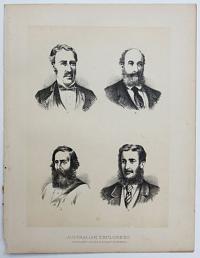
Australian Explorers. 1, Sir C. Grey. 2, Giles 3, Stuart 4, Forrest.
[Anon., c.1880]
Chromolithograph, printed area 160 x 220mm (6¼ x 8½").
Portraits of: Sir George Grey (1812-98), Ernest Giles (1835-97), C John McDouall Stuart (1815-66), and John Forrest (1847-1918). From a book of Australian views.
[Ref: 44030] £65.00
(£78.00 incl.VAT)

Australian Explorers.
McGready, Thomson & Niven / Copyright / McFarlane & Erskine Lithog.rs Edinburgh [c.1870's]
Lithograph with tintstone, sheet 265 x 170mm (10½ x 6¾").
Portraits of: Ernest Giles (1835-97), John Forrest (1847-1918), Charles Sturt (1795-1869), Robert O'Hara Burke (1821-61), William John Wills (1834-61), Ludwig Leichardt (1813-48), John McDouall Stuart (1815-66) and Sir George Grey (1812-98). In the centre is Charles Summers' monument to Burke and Wills in Melbourne. In 1860-1 Burke and Wills led an expedition crossing Australia from Melbourne in the south to the Gulf of Carpentaria in the north. They successfully did so but both men lost their lives on the return to Melbourne. Kivell & Spence: Pg 124.
[Ref: 37092] £85.00
(£102.00 incl.VAT)




![[32 original pencil sketches by Winifred Austen, drawn for] A Book of Dogs](jpegs/60126.jpg)

![[Music Sheet] Musical Bouquet. The Battle of Austerlitz Quadrille.](jpegs/55742.jpg)

![[Sarah Austin] Mrs Austin.](jpegs/48445.jpg)






![[The 1861 expedition of the Dempster Brothers, Clarkson & Harper in Western Australia, with map.]](jpegs/25655.jpg)
![[The 1863 expedition into the interior of Western Australia by Henry Maxwell Lefroy, with map.]](jpegs/25657.jpg)


![[Gum Tree] Vue d'un paysage Australien où figurent les Xanthorrhoea (sur l'arrière plan.)](jpegs/55362.jpg)


![[The 1861 expedition of Frank T. Gregory in north west Australia, with map.]](jpegs/25654.jpg)
![[Photograph of Australian Drawing.]](jpegs/41679.jpg)