Results 1-6 of 6
<<< Previous 1 Next >>>
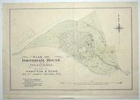
Plan of Broham House, Near Bedford. For Sale by Hampton & Sons, 20, St James' Square, S.W.1.
Estates Gazette, Lith, 33-35, Kirby St, E.C.
[n.d., c.1925.]
Lithographic map, printed border 235 x 355mm (9¼ x 14"). Original binding fold.
An estate agent's plan of the land around Broham House, near Bedford.
[Ref: 57640] £160.00
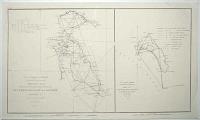
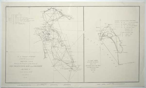
U.S. Coastal Survey. A.D. Bache Superintentent. Sketch J. No. 6, Showing the Progress of the Survey of San Francisco Bay and Vicinity. Section X. From 1850 to 1853. Scale 1/400,000 1853. ... Showing the Progress of the Survey in the Bay of San Diego California. Scale 1/200,000. 1853.
[Washington, 1854.]
Engraved map. Sheet 255 x 430mm (10 x 17"). With original binding folds.
A sheet with two charts from early trigonometrical surveys for the U.S. Coastal Survey under Alexander Dallas Bache (grandson of Benjamin Franklin).
[Ref: 57714] £140.00
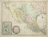
Mexico of Nieuw Spanje; tot het nagaan der vorderingen van Cortes. Tot Dr Robertson's Seschiedenisvan vam America. Door Thom.s Kitchin Sen.r Kaartmaaker zyner Britt. Majesteit.
A. v. Krevelt, sculps. Amsterd. 1778.
[Amsterdam, 1778.]
Engraved map with hand colouring. 290 x 400mm, very large margins. Original binding folds.
A map of the American south-west, with 'Tecas' (Texas) and New Mexico. From a Dutch edition of Dr. Robertson's 'History of America'.
[Ref: 57637] £250.00
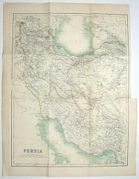
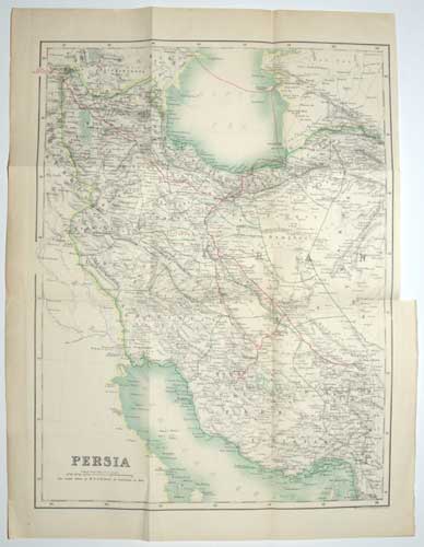
Persia. The route taken by M.r E.G. Browne is indicated in Red.
W. & A.K. Johnston, Edinburgh & London.
[Edinburgh: A. & C. Black, 1893.]
Lithographic map, printed in colours. Printed area 395 x 300mm (15½ x 11¾"). Repaired tear from original binding folds.
The general map from Edward Granville Browne's 'A Year Among the Persians', showing his route from Kurdinstan to Terhran, Shiraz and Kerman, and across the sea to Baku. Browne (1862-1926) was a British Iranologist who spent a year there in 1887-8. This account was very favourable towards the Persians, who reciprocated their feelings: a Tehran street named after him and a statue survived the Iranian Revolution in 1979.
[Ref: 57631] £130.00
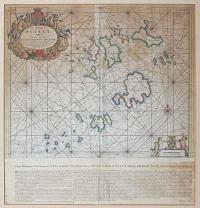
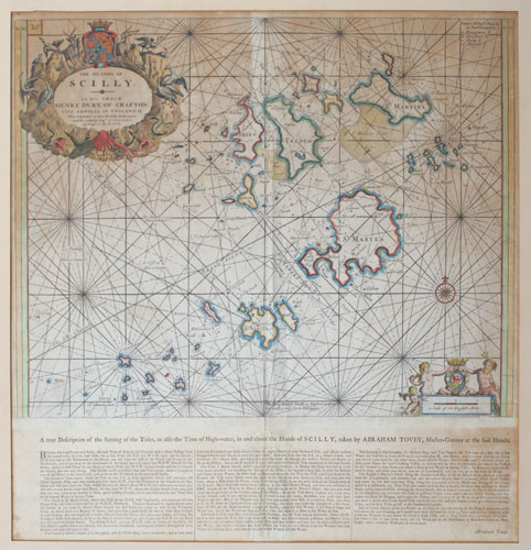
The Islands of Scilly.
[after Captain Greenvile Collins.]
[London: Mount & Page, c.1770.]
Engraved sea chart with hand colour. 455 x 570mm (18 x 22½"), with scarce extra letterpress pasted underneath. Some staining and toning.
A detailed chart of the Scilly Islands, published in the first sea atlas of the British Isles, first issued in 1693. This example has extra letterpress, 'A true Description of the Setting of the Tides... taken by Abraham Tovey, Master Gunner at the said Islands', pasted underneath, meaning the map had to be folded twice to fit in the volume. In it Tovey writes 'mind Dhese directions, and Captain Collin's Draught of these Islands, and you will come in safe. Tovey (1687-1759) was responsible for maintaining the defences of the Scillys for many years.
[Ref: 57722] £850.00
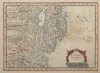
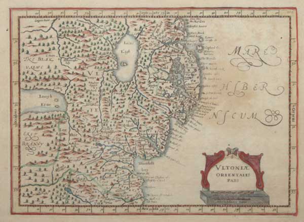
Ultoniae Orientalis Pars.
[engraved by Pieter van den Keere after Gerard Mercator.]
[Amsterdam: Jan Jansson van Waesberge, 1673.]
Engraved map with hand colour. 190 x 260mm (7½ x 10¼"), with large margins.
A map of eastern Ulster from Jan Cloppenburg's edition of the Mercator 'Atlas Minor', the largest of the pocket-size versions. First published in 1630 the plates were suppressed for many years before resurfacing for this last edition.
[Ref: 57716] £95.00
<<< Previous 1 Next >>>