Results 1-6 of 6
<<< Previous 1 Next >>>
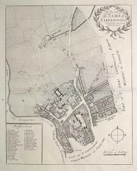
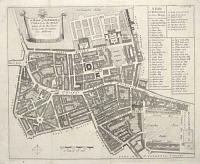
The Parish of S.t James Clerkenwell, Taken from ye last Survey with Corrections.
[n.d., c.1770.]
Engraved map, 18th century watermark. 365 x 290mm (14½ x 11½"), with very large margins.
A map of Clerkenwell centred on St John Street, marking Clerkenwell Green, St John's Priory, New River Pond and Sadler's Wells. Originally engraved for the 6th edition of Stow's 'Survey of London', 1720.
[Ref: 62526] £140.00
The Plan of Edinburgh Exactly done From the Original of ye famous D: Wit.
[after ]
Printed for, and Sold by J. Smith, at his Shop in the West End of Exeter Change in the Strand [n.d., c.1724].
Engraved map, two sheets of three. Plates 430 x 515mm (17 x 20¼") & 195 x 530mm (7¾ x 21"). Left plate trimmed within plate top and bottom, right plate trimmed to printed border on right; both plates with restoration. Minus top right portion.
Three-quarters of a plan of Edinburgh based on the survey by James Gordon of Rothiemay in 1647, printed by others including Frederick de Wit of Amsterdam and Andrew Slezer. It has been augmented by the prospect of the city, which was drafted c.1690.
[Ref: 62277] £350.00
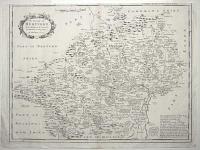
The County of Hertford, With Additions & Corrected and Amended in many Places.
H. Moll Fecit A.º 1700.
[London: Benjamin Griffin et al, 1700.]
Engraved map. 365 x 485mm (14¼ x 19"). Trimmed into printed border at top, creasing. Small margins.
A detailed map of Hertfordshire, engraved by Herman Moll not for a county atlas but for Sir Henry Chauncy's 'Historical Antiquities of Hertfordshire'.
[Ref: 62545] £140.00

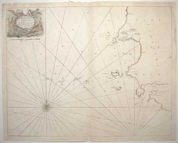
Milford Haven and the Islands Adjacent most Humbly dedicated and presented to S.r Hugh Owen Bar.t by Cap,t G. Collins, Hydrographer to their Majesties.
[London: Mount & Page, c.1750.]
Coloured sea chart. 450 x 575mm (17¾ x 22½"). Splits in centre fold taped. Slight stain centre right margin.
A sea chart of western Wales, originally published in ''Great Britain's Coasting Pilot'' by Captain Greenvile Collins in 1693. This was the first English sea atlas of English waters, but many of the charts appeared in other sea atlases until the 1770s.
[Ref: 62547] £160.00

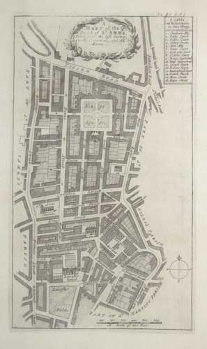
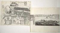
A Mapp of the Parish of St Anns, Taken from the last Survey with Corrections and Additions.
Engraved map. 320 x 185mm (12½ x 7¼") very large margins. Central crease as normal.
A map of Soho, bounded by Wardour Street in the west, Oxford Street in the north and Charing Cross Road (Hog Lane!) in the east, and Leicester Square (Leicester Fields) in the south. Soho Square is named King's Square. Originally engraved for the 6th edition of Stow's 'Survey of London', 1720.
[Ref: 62466] £160.00
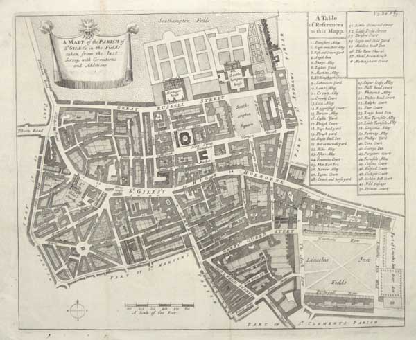
A Mapp of the Parish of St Giles's in the Fields taken from the last Survey with Corrections and Additions.
Engraved map. 330 x 370mm (13 x 14½"), very large margins. Folds and creases as normal. Small tear at bottom.
A map of the parish of St Giles, covering the Seven Dials area of Covent Garden, Great Russell Street (with Montague house, now the British Museum), High Holborn, Great Queen Street and Lincoln's Inn Fields. Originally engraved for the 6th edition of Stow's 'Survey of London', 1720.
[Ref: 62465] £190.00
<<< Previous 1 Next >>>