Results 1-6 of 6
<<< Previous 1 Next >>>
![[Frontis to Caldecott's Musical Miscellany MS Vol. III.]](img-thumbnail/jpegs/60980.jpg)
[Frontis to Caldecott's Musical Miscellany MS Vol. III.]
F. Bartolozzi sculp.
Goulding, D'Almaine, Potter & Co. Music Publishers 20 Soho Sq. [c.1810].
Etching. 115 x 210mm (4½ x 8¼") very large margins. Old ink mss. name added, crack in platemark, some spotting and creasing.
Mrs. Wadham Wyndham "Caldecott's Musical Miscellany MS Vol. III” was a musical score book printed by Goulding D'Almaine, Potter & Co music publishers and musical instrument sellers, with a cartouche design by Francesco Bartolozzi (1725-1815), filled with songs and pieces, most with titles and some composers, with an index of titles and composers at the back, and various verses at the front and comments on John Barratt at the back. Music publishers 'Goulding & D’Almaine' was founded in 1785; it became 'Goulding, D’Almaine, Potter & Co.' c.1810.
[Ref: 60980] £160.00
(£192.00 incl.VAT)
![[Frontispiece] Scelta di XXIV Vedute delle principali contrade, piazze, chiese, e palazzi della Città di Firenze.](img-thumbnail/jpegs/60929.jpg)
[Frontispiece] Scelta di XXIV Vedute delle principali contrade, piazze, chiese, e palazzi della Città di Firenze.
Giuseppi Magni del. Jon. Gottofred Seuter Sculps. Aug. Vind.
Appresso Giuseppe Bouchard libraio Francese in Firenze 1754.
Etching with engraving. 475 x 675mm (18¾ x 26½"), large margins. Small tear at bottom taped.
The titleplate to Zocchi's 24 views of Florence, with a dedication to Empress Maria Theresa, first published 1744. The design, featuring the Olympian Gods on the left and women bringing offerings to three crowned figures on the right, is adapted from a fresco by Giovanni da San Giovanni on the outside wall of a house opposite the Porta Romana.
[Ref: 60929] £360.00
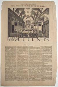
A Faithful Representation of the Interior of the House of Lords.
Printed by Smith and Melling, 18, Pool Lane, Liverpool.
[n.d., c.1820.]
Broadside, with wood engraving set in letterpress. Sheet 455 x 300mm (18 x 11¾"). Repaired tears, creasing.
A broadside published for the trial of Caroline of Brunswick, showing the temporary galleries erected to seat the extra visitors. The 'Table of Explanation' contains a key marking the positions of the main figures of the trial.
[Ref: 60901] £260.00
(£312.00 incl.VAT)
![[Sea atlas titlepage.] Le Neptune Francois, ou Atlas Nouveau des Cartes Marines pour l'Usage de ses Armées de Mer.](img-thumbnail/jpegs/60957.jpg)
[Sea atlas titlepage.] Le Neptune Francois, ou Atlas Nouveau des Cartes Marines pour l'Usage de ses Armées de Mer.
A Paris, Chez Hubert Jaillot aux deux Globes, M. D.C. LXXXXIII. Avec Privilege du Roy [but Amsterdam: Pierre Mortier, 1693].
Fine letterpress titlepage printed in black and red, with engraved vignette of a sea battle. Sheet 635 x 505mm (25 x 19¾") very large margins. Old ink mss. number top right.
The titlepage of the largest atlas of sea charts published up to that time. The vignette is signed by Jan van Vianen. The atlas was published in Amsterdam by Pierre Mortier, with a false publication line perhaps to avoid customs duties abroad. A companion volume contained the famous sea charts etched by Romain de Hooghe, dedicated to William III, the Dutch king of England.
[Ref: 60957] £220.00
(£264.00 incl.VAT)
![[Sea atlas titlepage.] Cartes Marines a l'Eusage des Armées du Roy de la Grande Bretane.](img-thumbnail/jpegs/60958.jpg)
[Sea atlas titlepage.] Cartes Marines a l'Eusage des Armées du Roy de la Grande Bretane.
A Amsterdam. Chez Pierre Mortier Libraire sur le Vygen Dam M. D.C. LXXXXIII [1693].
Fine letterpress titlepage printed in black and red, with engraved vignette of a sea battle. Sheet 635 x 505mm (25 x 19¾") very large margins. Old ink mss. number top right.
The titlepage to the magnificent atlas of sea charts etched by Romain de Hooghe, dedicated to William III, the new Dutch king of England. The suite of nine charts, described by Koeman as the 'most spectacular type of maritime cartography ever produced in 17th century Amsterdam', included the three-sheet chart of the Mediterrean. The vignette is signed by Jan van Vianen. Koeman: vol 4, p. 423-4, M. Mor 5.
[Ref: 60958] £220.00
(£264.00 incl.VAT)
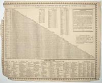
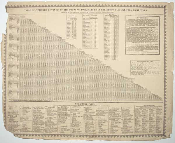
Table of Computed Distances of the Towns of Yorkshire from the Metropolis, and From Each Other. Compiled fo the History, Directory, and Gazetteer of Yorkshire. _ Published by Edward Baines, Leeds.
Leeds: Printed by Edward Baines [n.d., c.1822.]
Letterpress with wood engraved border. Sheet 430 x 530mm (17 x 21), paper watermarked 'H S 1816'. Damage, mainly to left borders but affecting text lower left corner, original folds.
The table of distance lists 74 places in Yorkshire and London. Other tables lists the stops on the mail routes from York to Edinburgh and London, the route from London to Paris via Dover, and the dates of the 'Fixed and 'Mouveable Fairs of the County and Ainsty of York'. Baines was editor of the Leeds Mercury newspaper. His 'History, Directory & Gazetteer of the County of York. With Select Lists of the Merchants & Traders of London, and the Principal Commercial and Manufacturing Towns of England, and a Variety of Other Commercial Information' was first published in 1822, with a second edition the following year.
[Ref: 60902] £320.00
<<< Previous 1 Next >>>
![[Frontis to Caldecott's Musical Miscellany MS Vol. III.]](jpegs/60980.jpg)
![[Frontispiece] Scelta di XXIV Vedute delle principali contrade, piazze, chiese, e palazzi della Città di Firenze.](jpegs/60929.jpg)

![[Sea atlas titlepage.] Le Neptune Francois, ou Atlas Nouveau des Cartes Marines pour l'Usage de ses Armées de Mer.](jpegs/60957.jpg)
![[Sea atlas titlepage.] Cartes Marines a l'Eusage des Armées du Roy de la Grande Bretane.](jpegs/60958.jpg)