Results 1-15 of 15
<<< Previous 1 Next >>>
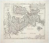
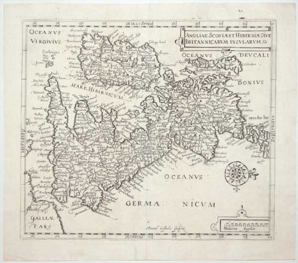
Anglie, Scotiae et Hiberniae Sive Britannicarum Insularum.
David Custodis Sculpsit.
[Frankfurt, 1627.]
Engraved map. 270 x 315mm (10¾ x 12½"). Repaired tear in bottom printed border.
Unusual map of the British Isles orientated east to west, based on the 1570 map by Abraham Ortelius but with details.
[Ref: 59230] £220.00
(£264.00 incl.VAT)
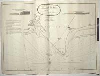
An Actual Survey of the Coast of Kent From Dim Church to Rye Harbour, with the New Shoal to the Westward of Dungeness.
By John Stephenson a Master in the Royal Navy.
London : Printed for Robert Sayer Nº 53 Fleet Street, as the Act direct, January 1st 1787.
Engraved map, 18th century watermark. 505 x 710mm (19¾ x 28"), very large margins. A small stain, near Ness.
A sea chart of the Kent coast from Winchelsea Castle to Dimchurch, with engraved sailing directions and two coastal profiles. As the 'new' shoal west of the Ness is now named 'Stephenson's Shoal', this is probably the first printed chart to name this sand-bank. Published as marine chronometers were being introduced, visual aids like the coastal profiles and the elevations of buildings in the towns were still important for coastal navigation.
[Ref: 59527] £220.00
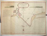
An Actual Survey of the Coast of Kent From Dim Church to Rye Harbour, with the New Shoal to the Westward of Dungeness.
By John Stephenson a Master in the Royal Navy.
London : Printed for Robert Sayer Nº 53 Fleet Street, as the Act direct, January 1st 1787.
Engraved map with hand colour, 18th century watermark. 505 x 710mm (19¾ x 28"), very large margins. A small stain.
A sea chart of the Kent coast from Winchelsea Castle to Dimchurch, with engraved sailing directions and two coastal profiles. As the 'new' shoal west of the Ness is now named 'Stephenson's Shoal', this is probably the first printed chart to name this sand-bank. Published as marine chronometers were being introduced, visual aids like the coastal profiles and the elevations of buildings in the towns were still important for coastal navigation.
[Ref: 59528] £260.00
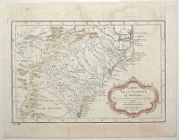
Carte de la Caroline et Georgie. Pour servir à l'Histoire Generale des Voyages.
Tirée des Auteurs Anglois par M.B. Ing. de la Marine. 1757.
[Paris: Didot Libraire, c.1757.]
Engraved map with hand colour, 18th century watermark. 200 x 300mm (8 x 11¾"). Binding folds, four pairs on worm holes in image, two near right plate mark. Offsetting.
A map of the US coastline from Albemarle Sound south to Jekyll Island (near Brunswick in Georgia). It extends inland to the Appalachians and parts of Eastern Tennessee. Published in Prevost's 'Histoire Generale des Voyages'.
[Ref: 59456] £260.00
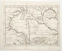
Carte de la Baye de Hudson. Pour servir à l'Histoire Generale des Voyages.
Par M. B. [Bellin] Ing.r de la Mar.e 1757.
[Paris: Didot Libraire, c.1757.]
Engraved map, 18th century watermark. 235 x 315mm (9¼ x 12½"). Narrow right margin, binding folds, slight damp staining.
A map of Hudson Bay and Newfoundland. A note in French top left states that 'the England search for a [North West] passage here but it doesn't exist'. Published in Prevost's 'Histoire Generale des Voyages'.
[Ref: 59459] £130.00
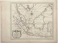
Carte des Isles de Java, Sumatra, Borneo &a. Les Détroits de la Sonde Malaca et Banca Golphe de Siam &a.
Par N. Bellin. Ing.r de la Marine.
[Paris: Didot Libraire, c.1760.]
Engraved map, 18th century watermark. 225 x 295mm (8¾ x 11½"). Binding folds.
A map of Indonesia, with the Malay Peninsula, Sumatra, Java, Borneo, the Celebes and Mindoro in the Philippines. Published in Prevost's 'Histoire Generale des Voyages'.
[Ref: 59454] £260.00
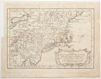
Carte de la Nouvelle Angleterre Nouvelle Yorck et Pensilvanie. Pour servir à l'Histoire Generale des Voyages.
Par M. B. [Bellin] Ing. de la Mar.e 1757.
[Paris: Didot Libraire, c.1757.]
Engraved map, 18th century watermark. 220 x 310mm (8½ x 12¼"). Trimmed to plate upper left by binder, folds with a small tear, 8 worm holes in image.
A map of the Eastern Seaboard from Delaware Bay north to Penobscot, and west to Lake Erie. Published in Prevost's 'Histoire Generale des Voyages'.
[Ref: 59458] £250.00
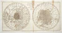
Carte des Deux Regions Polaires Jusq'au 45º Degré de Latitude.
[Paris: Sanson & Compagnie, 1786.]
Engraved map. Sheet 240 x 470mm (9½ x 18½"). Trimmed by binder lower left, toning at binding folds.
A twin-hemisphere map of the two polar regions to latitude 45º. In the northern hemisphere this includes Newfoundland, Bordeaux, the Caspian Sea, the Kuriles and a the North West Passage according to Amiral de Fonte. In the Antarctic the southern tips of Tasmania and New Zealand are shown, with Cape Horn. From Buffon's 'Histoire Naturelle, générale et particulière Tome 13'.
[Ref: 59452] £290.00
(£348.00 incl.VAT)
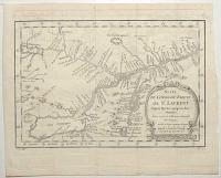
Carte du Cours du Fleuve de St Laurent Depuis Quebec jusqu'au Lac Ontarion. Pour servir à l'Histoire Générale des Voyages.
Par M.B. [Bellin] Ing. de la M.e 1757.
[Paris: Didot Libraire, c.1757.]
Engraved map, 18th century watermark. 210 x 310mm (8¼ x 12¼"). Binding folds, faint ink offset.
Map of the St Lawrence River, showing from Lake Ontario west to Quebec, with Montral and Lake Champelain. It was drawn in 1757 by Jacques Nicolas Bellin for Prevost's 'Histoire'. The Seven Years' War (1756-63) had already started: two years later Quebec fell to the English.
[Ref: 59453] £140.00

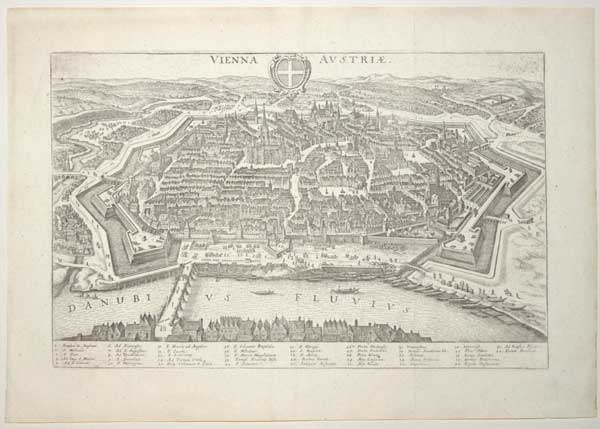
Vienna Austriae.
[Frankfurt, Matthaus Merian, 1640.]
Engraved map. 210 x 330mm (8¼ x 13"). Original binding folds as normal.
A map of Vienna in the style of a bird's-eye view, with a 42 point key. From Johann Gottfried's 'Neuwe Archontologia Cosmica'.
[Ref: 59628] £260.00
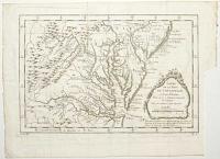
Carte de la Baye de Chesapeack et Pays Voisins. Pour servir à l'Histoire Generale des Voyages. Tirée des meilleures Cartes Angloises.
[Nicolas Bellin.]
[Paris: Didot Libraire, c.1757.]
Engraved map. 210 x 305mm (8¼ x 12"). Trimmed to plate lower right by binder, folds, two worm holes in image.
A map of the environs of Chesapeake Bay, with Virginia, Maryland and part of New Jersey. Published in Prevost's 'Histoire Generale des Voyages'.
[Ref: 59457] £260.00
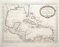
Carte du Golphe du Mexique et des Isles de l'Amerique. Pour servir à l'Histoire Generale des Voyages.
Par M. Bellin Ing.r de la Mar.e 1754.
[Paris: Didot Libraire, c.1757.]
Engraved map with hand colour, 18th century watermark; 290 x 390mm (11½ x 15¼"). Narrow right margin, binding folds, 16 worm holes.
A map of the West Indies and Gulf of Mexico. It marks the mythical island of Bermeja off Yucatan, belief in which lasted until quite recently but not found in a survey in 2009. A current conspiracy theory in Mexico claims that the Central Intelligence Agency destroyed the island to expand the economic zone allotted to the United States. Published in Prevost's 'Histoire Generale des Voyages'.
[Ref: 59460] £480.00
![[...This Map of the County of Worcester...]](img-thumbnail/jpegs/59549.jpg)
[...This Map of the County of Worcester...]
[Drawn, engraved and published by Isaac Taylor.]
[Ross-on-Wye, 1772.]
Engraved map, one sheet [of four], with original hand colour. 530 x 515mm (21 x 20¼"), with large margins. Some wear to edges. Slight creasing in right margin.
One sheet of Isaac Taylor's monumental four-sheet map of Worcestershire, showing the south-east of the county, decorated with a scale cartouche and compass rose. Taylor (c.1720-88, not to be confused with the engraver (1730-1807), lived at 54-55 High Street, Ross-on-Wye. He surveyed down plans and five large-scale county maps: Herefordshire 1754, Hampshire 1759, Dorset 1765, Worcestershire 1772, and Gloucestershire 1777.
[Ref: 59549] £230.00
![[...This Map of the County of Worcester...]](img-thumbnail/jpegs/59552.jpg)
[...This Map of the County of Worcester...]
[Drawn, engraved and published by Isaac Taylor.]
[Ross-on-Wye, 1772.]
Engraved map, one sheet [of four], with original hand colour. 530 x 515mm (21 x 20¼"), large margins. Some wear to edges. Tear top left.
One sheet of Isaac Taylor's monumental four-sheet map of Worcestershire, showing the north-west of the county, with Kidderminster, the map's key and gazetteer. Taylor (c.1720-88, not to be confused with the engraver (1730-1807), lived at 54-55 High Street, Ross-on-Wye. He surveyed down plans and five large-scale county maps: Herefordshire 1754, Hampshire 1759, Dorset 1765, Worcestershire 1772, and Gloucestershire 1777.
[Ref: 59552] £180.00
![[...This Map of the County of Worcester...]](img-thumbnail/jpegs/59553.jpg)
[...This Map of the County of Worcester...]
[Drawn, engraved and published by Isaac Taylor.]
[Ross-on-Wye, 1772.]
Engraved map, one sheet [of four], with original hand colour. 530 x 515mm (21 x 20¼") very large margins. Some wear to edges.
One sheet of Isaac Taylor's monumental four-sheet map of Worcestershire, showing the north-east of the county, with Droitwich, Stourbridge and Dudley, also marking Edbaston and Birmingham across the border with Warwickshire. Taylor (c.1720-88, not to be confused with the engraver (1730-1807), lived at 54-55 High Street, Ross-on-Wye. He surveyed down plans and five large-scale county maps: Herefordshire 1754, Hampshire 1759, Dorset 1765, Worcestershire 1772, and Gloucestershire 1777.
[Ref: 59553] £230.00
<<< Previous 1 Next >>>




![[...This Map of the County of Worcester...]](jpegs/59549.jpg)
![[...This Map of the County of Worcester...]](jpegs/59552.jpg)
![[...This Map of the County of Worcester...]](jpegs/59553.jpg)