Results 1-5 of 5
<<< Previous 1 Next >>>

A Plan of Hyde Park and Part of the City of London, shewing A Position for A Royal Palace, with a Proposed Street, leading directly from thence to S.t Paul's, as suggested by Colonel Tremch. The design for the Palace and the Street, by Phil.p Wyatt, Arch.t.
G. & J. Cary, sculp, 86 S.t James's Street.
[n.d., c.1827.]
Engraved map with hand colour. 185 x 695mm (7¼ x 27½"), with 'J. Whatman 1824' watermark. Folds, laid on album paper with a lithograph.
A plan for a new Royal Palace in Hyde Park with a new road carved in a straight line through London's West End to St Paul's Cathedral. It also shows Sir Frederick William Trench's plan for a Thames Embankment. Despite George IV's enthusiasm neither palace nor road was built. The additional etching is 'Design for laternal instead of the present frontal Pavillion's for the New Palace St James Park intended to groupe with the marble arch of Georgius Quartus', 'Designd and etched by William Bardwell'. It is an elevation of a massive neo-classical facade.
[Ref: 64132] £360.00
![[Environs of London] General Map.](img-thumbnail/jpegs/61725.jpg)
[Environs of London] General Map.
[London: John Cary, n.d., 1786.]
Engraved map with outline colour. Sheet 180 x 205mm (7 x 8"). Surface soiling, central fold, as usual.
A sketch map of the environs of London, extending from Uxbridge in the west, clockwise to North Mims, Chipping Ongar, Thurrock, Coulsdon and Weybridge. The county boundaries are marked in colour. From ''Cary's Actual Survey of the Country Fifteen Miles round London''.
[Ref: 61725] £95.00
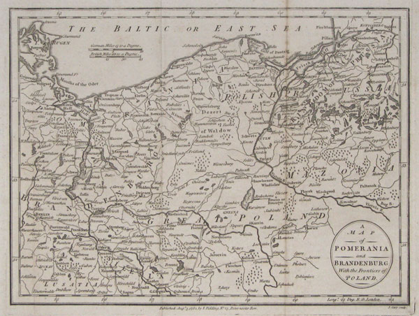
A Map of Pomerania and Brandenburg with the Frontiers of Poland.
J.Cary sculp.
Published Aug.t 3 1782 by I.Fielding No 23 Pater-noster Row.
Engraving. 200 x 260mm, 8 x 10¼". Folded, some toning.
Northern Poland, with Gdansk. At the time of publication these areas were part of Germany. From the 'Complete Geographical Dictionary' by John Seally.
[Ref: 13227] £65.00
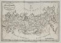
The Russian Empire in Europe and Aisa: from the best Authorities.
J.Cary sculp.
Published Sep.r 28 1782 by I.Fielding No 23 Pater noster Row.
Engraving. 195 x 270mm, 7¾ x 10½". Folded.
Map from the 'Complete Geographical Dictionary' by John Seally.
[Ref: 13222] £75.00

Plan of St Petersburg with its fortifications.
J.Cary sculp.
Published July 6 1782 by I.Fielding No 23 Pater-noster Row.
Engraving. 200 x 260mm, 8 x 10¼". Folded, narrow left margin. Creasing.
Plan of St Petersburg, with an inset showing the Neva River to Lagoda Lake and the Neva Canal. From the 'Complete Geographical Dictionary' by John Seally.
[Ref: 13226] £140.00
<<< Previous 1 Next >>>

![[Environs of London] General Map.](jpegs/61725.jpg)