Results 1-3 of 3
<<< Previous 1 Next >>>

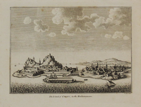
The Island of Corfu, in the Mediterranean.
F. Cary sculp.t [c.1790]
Engraving, platemark 185 x 245mm (7¼ x 9½"). Very slight crease left corner. Very large margins.
Good early view of the east coast of the island of Corfu, showing the Venetian Old Fortress. The island was ruled by Venetian nobility between 1386 and 1797.
[Ref: 38659] £75.00
(£90.00 incl.VAT)
![A Map of the Island of Jersey Drawn from the Survey of Philip Dumaresq Esq.r Seigneur of Samares, [also with the Isle of Man, Alderney, & Garnsey ot Sarina.]](img-thumbnail/jpegs/19639.jpg)
A Map of the Island of Jersey Drawn from the Survey of Philip Dumaresq Esq.r Seigneur of Samares, [also with the Isle of Man, Alderney, & Garnsey ot Sarina.]
Engraved by J. Cary.
[n.d. c.1805.]
Coloured engraving. Sheet 539 x 418mm. 21¼ x 16½". Two horizontal folds. Creasing and tear to lower right.
Philip Dumaresq, who responsible for digging the 'canal' to drain the Samares salt marsh. This map was engraved by John Cary in 1805 for John Stockdale's "New British Atlas".
[Ref: 19639] £190.00

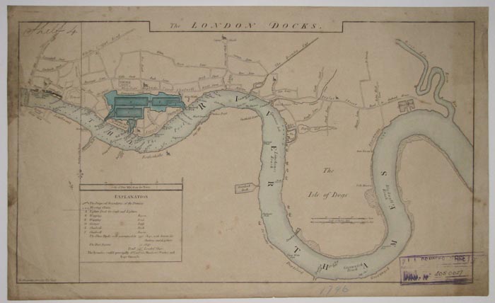
The London Docks.
D. Alexander Surveyor Nov.r 1796 J. Cary engraver Strand.
Coloured map, 295 x 505mm. 11½ x 20". Staining and foxing; tear at top in middle.
The Thames between London Bridge and the River Lea, showing locations of London docks with many other landmarks indicated. From the Port of London Authority archives.
[Ref: 11299] £220.00
<<< Previous 1 Next >>>
![A Map of the Island of Jersey Drawn from the Survey of Philip Dumaresq Esq.r Seigneur of Samares, [also with the Isle of Man, Alderney, & Garnsey ot Sarina.]](jpegs/19639.jpg)