Results 1-13 of 13
<<< Previous 1 Next >>>
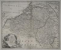
A New & Accurate Map of the Netherlands or Low Countries. Laid down from the best Authorities, assisted by the most approved Modern Maps and Regulated by Astron.l Observations.
by Eman. Bowen.
[London, c.1747.]
Engraved map. 360 x 440mm, 14¼ x 17¼".
Map of Belgium and Luxembourg, published in 'A Complete System of Geography'. A text refers to the Barrier Treaty of 1715, during the War of the Spanish Succession.
[Ref: 13579] £85.00
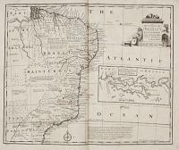
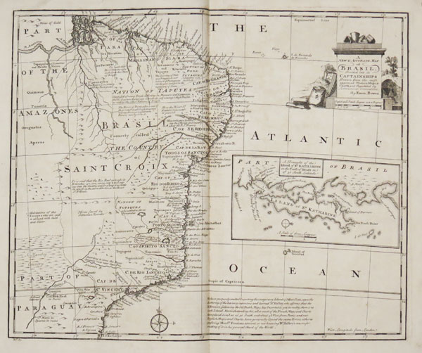
A New & Accurate Map of Brasil, divided into its Captainships. Drawn from the most approved Modern Maps & Charts, & Regulated by Astronomical observations
By Eman. Bowen.
[London: Printed for William Innys, Richard Ware, Aaron Ward, J. and P. Knapton, John Clarke, T. Longman and T. Shewell, Thomas Osborne, Henry Whitridge, 1749.]
Engraved map. 360 x 425mm (14¼ x 16¾").
A map of Brazil with an inset map of the island of St Katherine (Santa Catarina Island), published in Emanuel Bowen's 'A Complete System of Geography'. The map contains a note: 'We have purposefully omitted Inserting the imaginary Island of Ascension, upon the Authority of the late very ingenious and learned Dr Halley'..
[Ref: 34191] £260.00
Unfortunately this item is either sold or reserved. If you are interested in similar items and cannot find what you're looking for on our website, please consider filling in our interests form. If you register, we can also send you items that match your interests when the website is updated.
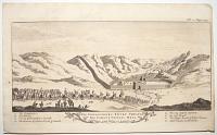
The Embassadors Entry Through the Famous Chinese Wall Near 1200 Miles in Length.
[Engraved by Emanuel Bowen.]
[London: Awnsham & John Churchill, 1744.]
Engraving. Plate 220 x 340mm (8¾ x 13½"). Trimmed on right.
The Great Wall of China, with a Russian embassy approaching. From 'A Complete Collection of Voyages and Travels' by John Harris.
[Ref: 53070] £230.00
(£276.00 incl.VAT)

A New & Accurate Map of the Island of Jamaica. Divided into its principal parishes.
Drawn from surveys and regulated by astron.l observat.ns by Eman. Bowen.
[London: Printed for William Innys, Richard Ware, Aaron Ward, J. and P. Knapton, John Clarke, T. Longman and T. Shewell, Thomas Osborne, Henry Whitridge, 1749.]
Engraved map. 355 x 430mm (14 x 17"). Printer's crease, folds as normal
A map of Jamaica with inset charts of Port Antonio & St Francis and Kingston. Published in Emanuel Bowen's 'A Complete System of Geography'.
[Ref: 62159] £320.00

A New & Accurate Map of the Island of Jamaica. Divided into its principal parishes. Drawn from surveys and regulated by astron.l observat.ns
By Eman. Bowen.
[London: Printed for William Innys, Richard Ware, Aaron Ward, J. and P. Knapton, John Clarke, T. Longman and T. Shewell, Thomas Osborne, Henry Whitridge, 1749.]
Engraved map. 355 x 430mm (14 x 17"). Split at centre fold.
A map of Jamaica with inset charts of Port Antonio & St Francis and Kingston. Published in Emanuel Bowen's 'A Complete System of Geography'.
[Ref: 34188] £180.00
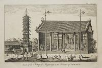
Inside of the Temple Jugangu in the Province of Peking. Vol. 2. page 940.
[Emanuel Bowen.]
[n.d., c.1748.]
Engraving. Plate: 210 x 320mm (8¼ x 12½''). Creasing on bottom left.
A view of the interior of a Buddhist temple in China. A plate from 'Navigantium atque Itinerantium Bibliotheca or A Compleat Collection of Voyages and Travels' published in 1748.
[Ref: 48762] £160.00
(£192.00 incl.VAT)
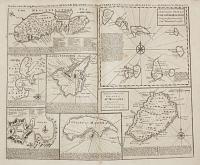
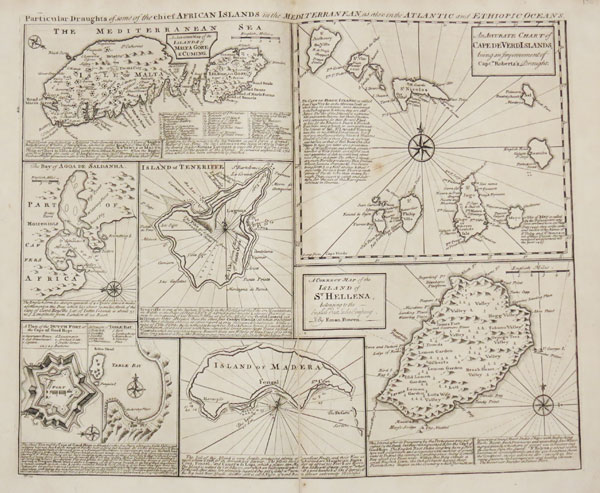
Particular Draughts of some of the chief African Islands in the Mediterranean, as also in the Atlantic and Ethiopic Oceans.
By Eman. Bowen.
[London: Printed for William Innys, Richard Ware, Aaron Ward, J. and P. Knapton, John Clarke, T. Longman and T. Shewell, Thomas Osborne, Henry Whitridge, 1749.]
Engraved map. 360 x 425mm (14¼ x 16¾").
Eight maps on one sheet: Malta, Gozo & Comino; Saldanha Bay, the Dutch fort at the Cape of Good Hope and Table Bay, all South Africa; Tenerife; Madeira; the Cape Verde Islands; and St Helena. Published in Emanuel Bowen's 'A Complete System of Geography'.
[Ref: 34200] £240.00
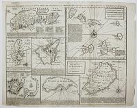
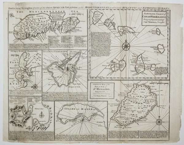
Particular Draughts of some of the chief African Islands in the Mediterranean, as also in the Atlantic and Ethiopic Oceans
[St Helena signed] By Eman. Bowen.
London, c.1747.
Engraved map. Sheet 370 x 475mm (14½ x 18¾"). A few small tears, edges worn.
Eight maps on one sheet: Malta, Gozo & Comino; Algoa de Saldana; Teneriffe; Cape Verde Islands; St Helena; Madeira; Table Bay; and 'A Plan of the Dutch Fort at the Cape of Good Hope'.
[Ref: 48930] £280.00
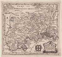
Middlesex. Drawn from Surveys & most approved Maps By Eman: Bowen Geograph.r to His Majesty.
Printed for J. Hinton at the Kings Arms in Newgae Street 1752.
Engraved map. 190 x 205mm (7½ x 8"). Mounted on album paper.
A small-format map of Middlesex, with the streets of London shown, decorated with an ornate baroque title cartouche and the arms of the City of London. From 'The Universal Magazine of Knowledge and Pleasure'; because it was not published in an atlas the map is uncommon.
[Ref: 61726] £180.00

A New Chart of the Vast Atlantic Ocean; exhibiting The Seat of War, both in Europe and America, likewise the Trade Winds & Course of Sailing from one Continent to the other, with the Banks, Shoals and Rocks drawn according to the latest discoveries, and regulated by Astronomical Observations.
Eman.l Bowen Sculp.
Publish'd according to Act of Parliament, for the London Magazine 1755.
Engraved map. 320 x 440mm (12½ x 17¼"). Several repaired tears, with loss of image made up.
A map of the Atlantic, off the Madeiras, covering from southern England in the top right, clockwise to the Slave Coast of Guinea, Cayenne in South America and Newfoundland. Top centre is 'A Table Comparing this Chart with Mr. Popples great Map of the British Empire in America'. This map was first published in 1740, during the War of Jenkins' Ear (1739-48), which was fought over the 'Asiento de Negros', the right for England to sell slaves in Spanish America. Thus the map covers the Triangular Slave Trade. This example was issued just before the outbreak of the Seven Years' War.
[Ref: 61557] £280.00
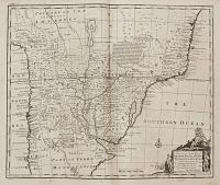
A New & Accurate Map of Paraguay, Rio de la Plata, Tucumania Guaria &c. Laid down from the latest Improvements and Regulated by by Astronomical observations
By Eman. Bowen.
[London: Printed for William Innys, Richard Ware, Aaron Ward, J. and P. Knapton, John Clarke, T. Longman and T. Shewell, Thomas Osborne, Henry Whitridge, 1749.]
Engraved map. 360 x 425mm (14¼ x 16¾").
A map centred on the Rio de la Plata, showing Peru, Bolivia, Paraguay, Uruguay & Argentina. Published in Emanuel Bowen's 'A Complete System of Geography'.
[Ref: 34199] £240.00
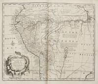
A New & Accurate Map of Peru and the Country of the Amazones. Drawn from the most authentick French Maps &c and Regulated by Astronomical observations
By Eman. Bowen.
[London: Printed for William Innys, Richard Ware, Aaron Ward, J. and P. Knapton, John Clarke, T. Longman and T. Shewell, Thomas Osborne, Henry Whitridge, 1749.]
Engraved map. 360 x 430mm (14¼ x 17").
A map of Peru but also showing Amazon River and its tributaries. Published in Emanuel Bowen's 'A Complete System of Geography'.
[Ref: 34197] £240.00
![[Battle of Rossbach] A Plan of the Battle of Weissenfels](img-thumbnail/jpegs/52006.jpg)
[Battle of Rossbach] A Plan of the Battle of Weissenfels between the King of Prussia on one Side & the combined Armies of France & the Empire on the the other, November 5th 1757.
Drawn on the Spot by Mos. Freadm Aid de Camp to Gen.l Bourkm and Capt: Engineer in his Prussian Majesty's Service. Engrav'd by Eman.l Bowen Geog.r to his Britannick Majesty.
Published according to Act of Parliament Nov.r 29th 1757, and sold by J. Robinson and G. Kearsly at the Golden Lion in Ludgate Street: Price 1s.
Engraving with old colour. 215 x 320mm (8½ x 12½"), large margins. Creases and folds.
A plan of the Battle of Rossbach, fought as part of the Third Silesian War (1756-63, a local theatre of the Seven Years' War). Led by Frederick the Great, the Prussian army crushed a French/Imperial army twice its size in 90 minutes, without deploying its full strength. The Prussian dead and wounded were fewer than 700 against 3,500 (including six generals), with at least 5,000 soldiers captured.
[Ref: 52006] £180.00
(£216.00 incl.VAT)
<<< Previous 1 Next >>>





![[Battle of Rossbach] A Plan of the Battle of Weissenfels](jpegs/52006.jpg)