Results 1-14 of 14
<<< Previous 1 Next >>>
![[Album of 9 Watercolours of England.]](img-thumbnail/jpegs/42587.jpg)
[Album of 9 Watercolours of England.]
[Painted by Rev. Thomas Bisse.]
[1785-1805.]
An album containing nine albumen-based watercolours in limp marbled wrappers. Album: 310 x 255mm (12 x 10").
A collection of 9 watercolours including views of Beaconsfield, Bristol and Malvern by the Rev. Thomas Bisse who lived at Portnall Park, now known as the Wentworth Estate, Virginia Water.
[Ref: 42587] £450.00
view all images for this item

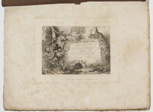
Twenty Etchings, by W. De La Motte, from Sketches made in the Neighbourhood of Sandhurst, in 1816.
Published by W. de la Motte, Sandhurst, near Bagshot; and by J. Dickinson, late J.P. Munn, 114, New Bond Street. / Glendinning, Printer, Hatton Garden, London.
Folio, twenty plates as called for with original stitching and front wrapper, 310 x 250mm (12¼ x 9½"). Damage to wrapper; some foxing to plates. Small worm hole to last 12 plates.
Set of topographical etchings in the vicinity of Sandhurst, Berkshire, by William Delamotte (1775-1863), landscape artist. From 1812 Delamotte was a drawing master at the Royal Military College in Sandhurst. Influenced by Girtin's watercolour style, Delamotte was one of a group of landscape artists also including Constable and Turner, who took to making oil sketches in the open. Previously Delamotte had spent four years living in Oxford, also as a drawing master, and several of Delamotte's earlier prints show views in and around Oxford. Ex Collection of the Hon. Christopher Lennox-Boyd.
[Ref: 35676] £600.00
view all images for this item
![[Thirty etchings by William Delamotte]](img-thumbnail/jpegs/35677.jpg)
[Thirty etchings by William Delamotte]
Book, 4to (340 x 250mm, 13½ x 9¾). Green morocco, with gilt border decoration and gilt stamped banded spine inscribed 'Etchings by Delamotte'. Gilt stamped cover inscribed 'Royal Military College / Presented for Attention to, and Progress In, Landscape Drawing' with royal coat of arms on front and back cover. Ms. inside cover identifying Gentleman Cadet Thomas H. Lovett as recipient, November 1834. Etchings printed c.1834 (first published 1816-7).
Two sets of topographical etchings in the vicinity of Sandhurst, Berkshire (of twenty and ten plates respectively) by William Delamotte (1775-1863), landscape artist. From 1812 Delamotte was a drawing master at the Royal Military College in Sandhurst. He was still teaching there in 1834, when this volume was presented to a cadet for his achievements in landscape drawing, so it is likely that Delamotte was personally involved with the production and presentation of the volume. Influenced by Girtin's watercolour style, Delamotte was one of a group of landscape artists also including Constable and Turner, who took to making oil sketches in the open. Previously Delamotte had spent four years living in Oxford, also as a drawing master, and several of Delamotte's earlier prints show views in and around Oxford. Ex Collection of the Hon. Christopher Lennox-Boyd.
[Ref: 35677] £850.00
view all images for this item
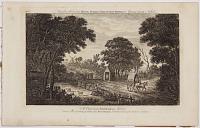
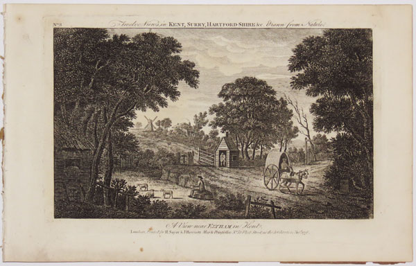
Twelve Views in Kent, Surry, Hartford-shire &c. Drawn from Nature. A View near Eltham in Kent. [&] A Cottage near Dartford in Kent. [&] A View near Chatham in Kent. [&] A View near Epsom in Surrey. [&] A View near Sevenoak in Kent. [&] A View of a Farm near Darking Surrey. [&] A Watermill near Hemel Hempstead Hartfordshire. [&] A View near Rickmansworth in Hertfordshire. [&] A View near Watford in Hertfordshire. [&] A View of a Farm near Lewes in Sussex. [&] Moon Light. [&] Snow Piece.
London, Printed for R. Sayer & J. Bennett, Map and Printsellers No 53 in Fleet Street, as the Act directs 12 Dec.r 1778.
Set of twelve numbered engravings, with large margins; stitched. Each plate c.180 x 280mm (7 x 11").
Twelve numbered views, stitched as issued.
[Ref: 31567] £620.00
view all images for this item

Londres. Les Capitales De L'Europe. Promenades Pittoresques. Londres. Paroisse de Ste. Mary-le-Bone.
Par M. Charles Malo.
Paris, Marcilly Fils Ainé, Rue S.-Jacques, No.21. Imprimerie de A. Firmin Didot, Rue Jacob, No.24. Relié chez Boullenger Md. Papetier-Relieur. Rue de la Paroisse. No.53 a Versailles. [n.d. c.1829.]
Small 12mo book, 36 pages, pink board cover embossed and with title printed in black; with hand-coloured aquatint. 152 x 95mm. 6 x 3¾". Some foxing.
Charles Malo (1790-1871) produced a series of books on the capital cities of Europe, in French, and recorded details of daily life in the cities, historical information and architectural details of churches and significant public buildings. The frontispiece is a view of the Parish of St. Marylebone.
[Ref: 17660] £260.00
view all images for this item

Views Of The Old And New London Bridges. Drawn And Etched By Edward William Cooke. With Scientific And Historical Notices Of The Two Bridges; Practical Observations On The Tides Of The River Thames; And A Concise Essay On Bridges, From The Earliest Period; &c.&c. Derived From Information Contributed Exclusively For This Work, by George Rennie, Esq. F.R.S. F.A.S. &c.&c.
London: Published By Brown And Syrett, 17, Old Broad-Street; J. And A. Arch, Cornhill; Paul And Dominic Colnaghi And Co. Printsellers To The Royal Family, Pall Mall East; And George And E.W. Cooke, Barnes Terrace, Surrey. 1833.
Complete set of 12 etched plates, loose but offered with original brown cloth-covered binding (folio, 500 x 355mm, 19¾ x 14") and text. 'Old And New London Bridges' stamped in gilt on cover.
Views on the Thames of stages in the demolition of the old London Bridge, and the construction of John Rennie's new bridge. In 1800 it was decided to replace the old bridge, and a competition was held producing many varied designs. In 1824, Rennie's plans were accepted. The bridge was built 180 feet west of the old Bridge and for a time Londoners could see both the old bridge and the new side-by-side. On June 15, 1825, the Lord Mayor of London, John Garratt, laid the first stone, in the presence of the Duke of York. This London Bridge was built out of granite which was quarried on Dartmoor. It was a structure of 5 arches, overall dimensions were 928 feet long and 49 feet wide. When the new bridge was finished and opened by King William and Queen Adelaide in 1831, traffic switched to the huge new structure and the demolition commenced on the old bridge. Edward William Cooke (1811 - 1880) draughtsman, illustrator, wood engraver, etcher and painter of rural and coastal scenes in oil and watercolour; son of engraver George Cooke. He was elected RA in 1864 and produced a number of drawings at Redleaf, the home of William Wells. Dedicated by the artist in ink on the titlepage: 'From E.W. Cooke, to his kind friend [name erased] Venice, Sept. 1853.' British Library: 000773987.
[Ref: 9819] £1,500.00
view all images for this item
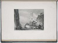
Views of London and its Vicinity. Complete in forty-eight plates, engraved on copper.
by George Cooke, from Drawings by Callcott, R.A., Stanfield A.R.A. Prout. Roberts. Stark. Harding. Cotman. Havell. &c. &c. After the Original Sketches made on the Spot by Edward W. Cooke.
London: Published by Longman & Co. Paternoster-Row; J. & A. Arch, Cornhill; Hodgson, Boys, and Graves, Pall Mall; and Mrs. G. Cooke, Barnes, Surrey.
375 x 280mm. 15 x 11". Some spotting. Binding worn.
Large paper copy containing all 48 plates, in original green binding. Rubbed.
[Ref: 9399] £780.00
view all images for this item
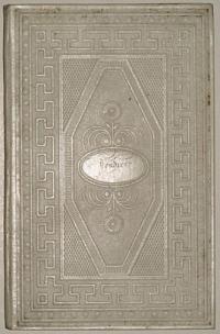
Londres. Les Capitales De L'Europe. Promenades Pittoresques. Londres. Paroisse de Ste. Mary-le-Bone.
Par M. Charles Malo.
Paris, Marcilly Fils Ainé, Rue S.-Jacques, No.21. Imprimerie de A. Firmin Didot, Rue Jacob, No.24. Relié chez Boullenger Md. Papetier-Relieur. Rue de la Paroisse. No.53 a Versailles. [n.d. c.1829.]
Small 12mo book, 36 pages, white board cover embossed and with title printed in black; with hand-coloured aquatint. 152 x 95mm. 6 x 3¾". Some foxing.
Charles Malo (1790-1871) produced a series of books on the capital cities of Europe, in French, and recorded details of daily life in the cities, historical information and architectural details of churches and significant public buildings. The frontispiece is a view of the Parish of St. Marylebone.
[Ref: 17535] £260.00
view all images for this item
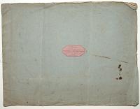
View's on the Border of South Wales, Engraved in imitation of Chalk. [Plates] No 1. Front view of St Brevals Castle, Gloucestershire. [&] No 2. Side view of St Brevals Castle, Gloucestershire. [&] No 3. View of Lady's Tower, Goodrich Castle, Herefordshire. [&] No 4. View of MacBeth's Tower, Goodrich Castle, Herefordshire.
[Drawn and engraved by Franz Josef Mannskirsch.]
Pub.d at R. Ackermann's Gallery, 101 Strand [Oct.r 1, 1798.]
Oblong folio, blue paper wrappers with title label; 4 numbered soft ground etchings, as called for, sheets 325 x 410mm (10¾ x 16"). Wrappers scuffed, plates slightly soiled. Slight creasing.
A rare set of four views, none of which are of Wales, despite the title. Franz Joseph Manskirch (1768-1830), born in Ehrenbreitstein, Germany; came to London in 1793 and exhibited at the R.A. until 1819. He then moved to Danzig, where he died.
[Ref: 52741] £350.00
view all images for this item

Twelve Views in Middlesex and Essex, Drawn from Nature. A View near Epping in Essex. [&] A View near Colchester in Essex. [&] A Cottage near Harrow, Middlesex. [&] A View near Brentwood, Essex. [&] A View near Uxbridge, Middlesex. [&] A View near Staines Middlesex. [&] A View near Barnett, Middlesex. [&] A View near Malden, Essex. [&] A Snow Piece. [&] A Cottage near Finchley, Middlesex. [&] The Ass Race. [&] Hop Pickers.
Printed by Rob.t Sayer, Map & Printseller at No 53 in Fleet Street London. [n.d., c.1770.]
Set of twelve numbered engravings, stitched. Each plate c.180 x 280mm (7 x 11"), with wide margins. Staining on first plate.
Twelve numbered views, stitched as issued.
[Ref: 31566] £620.00
view all images for this item
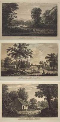
Twelve Views in Middlesex and Essex, Drawn from Nature. A View near Epping in Essex. [&] A View near Colchester in Essex. [&] A Cottage near Harrow, Middlesex. [&] A View near Brentwood, Essex. [&] A View near Uxbridge, Middlesex. [&] A View near Staines Middlesex. [&] A View near Barnett, Middlesex. [&] A View near Malden, Essex. [&] A Snow Piece. [&] A Cottage near Finchley, Middlesex. [&] The Ass Race. [&] Hop Pickers.
London, Printed for R. Sayer & J. Bennett, No 53 in Fleet Street, as the Act directs 10 Oct.r 1779.
Set of twelve numbered engravings, originally stitched but disbound. Each plate c.180 x 280mm (7 x 11"), with large margins. Stitch holes in left margin.
Dupl. Ref: 31566.
[Ref: 58018] £480.00
view all images for this item
![Notable English Places [stamped in gilt on spine].](img-thumbnail/jpegs/7430.jpg)
Notable English Places [stamped in gilt on spine].
4to, cloth backed boards, gilt morocco title label on spine, 28 fine aquatint plates interleaved by text sheets. Binding generally worn and tatty, plates good strong unsoiled impressions.
Fine aquatints of notable English houses etched by John Hassell (1767 - 1825) after his own designs. Hassell lived in London and worked sometimes as a drawing master and wrote several books on drawing and watercolour painting. Not in Abbey scenery.
[Ref: 7430] £750.00
![[Twelve views of royal palaces.]](img-thumbnail/jpegs/31568.jpg)
[Twelve views of royal palaces.]
London, Printed for Rob.t Sayer, at the Golden Buck near Sarjeants Inn, Fleet Street. [n.d., c.1779].
Set of twelve numbered engravings, with large margins; stitched. Each plate c.180 x 280mm (7 x 11").
Twelve numbered views, stitched as issued, with three views each of Hampton Court, Kensington Palace, Kew Palace & Windsor Great Park. Two of the Windsor prints are copied from Thomas Sandby.
[Ref: 31568] £680.00
view all images for this item
![Tableau de Londres [title on spine].](img-thumbnail/jpegs/44005.jpg)
Tableau de Londres [title on spine]. Description Géographique, Topographique, Pittoresque, Industrielle et Commerciale. de L'Angleterre, de L'Écosse et de L'Irelande... Par Crutwell, Traduite de l'anglais, sur la 4e. édition; ... Tome Quatrième.
A Paris, Chez Hyacinthe Langlois, Libraire pour la Géographie, l'Histoire, les Belles-Lettres, quai des Augustins, no 67, près le Pont Neuf. M.DCCC.IV. [1804.]
8vo, original full calf gilt, maroon morocco title label, speckled edges, marbled endpapers; title + 385, folding engraved map frontis. Spine with rubbed patch, small fold split in margin of map.
A French tourist's guide to London, probably prepared for publication during the thaw in Anglo-French relations after the Treaty of Amiens of 1802. The text consists of information neccessary for the tourist: an extensive key for the map; lists of carriage fares within London (including a specific table of fares from various point to the Opera House, Drury Lane Theatre, Covent Garden Theatre and Ranelagh Gardens); how to get coaches to the villages surrounding London (including Barnes, Clapham, Hammersmith, Hampstead, Kingston & Richmond) and ferry prices.
[Ref: 44005] £360.00
view all images for this item
<<< Previous 1 Next >>>
![[Album of 9 Watercolours of England.]](jpegs/42587.jpg)
![[Thirty etchings by William Delamotte]](jpegs/35677.jpg)




![Notable English Places [stamped in gilt on spine].](jpegs/7430.jpg)
![[Twelve views of royal palaces.]](jpegs/31568.jpg)
![Tableau de Londres [title on spine].](jpegs/44005.jpg)