The Parish of S.t James Clerkenwell, Taken from ye last Survey with Corrections.
[n.d., c.1770.] Engraved map, 18th century watermark. 365 x 290mm (14½ x 11½"), with very large margins. A map of Clerkenwell centred on St John Street, marking Clerkenwell Green, St John's Priory, New River Pond and Sadler's Wells. Originally engraved for the 6th edition of Stow's 'Survey of London', 1720.
[Ref: 62526] £140.00
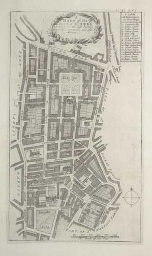
A Mapp of the Parish of St Anns, Taken from the last Survey with Corrections and Additions.
Engraved map. 320 x 185mm (12½ x 7¼") very large margins. Central crease as normal. A map of Soho, bounded by Wardour Street in the west, Oxford Street in the north and Charing Cross Road (Hog Lane!) in the east, and Leicester Square (Leicester Fields) in the south. Soho Square is named King's Square. Originally engraved for the 6th edition of Stow's 'Survey of London', 1720.
[Ref: 62466] £160.00
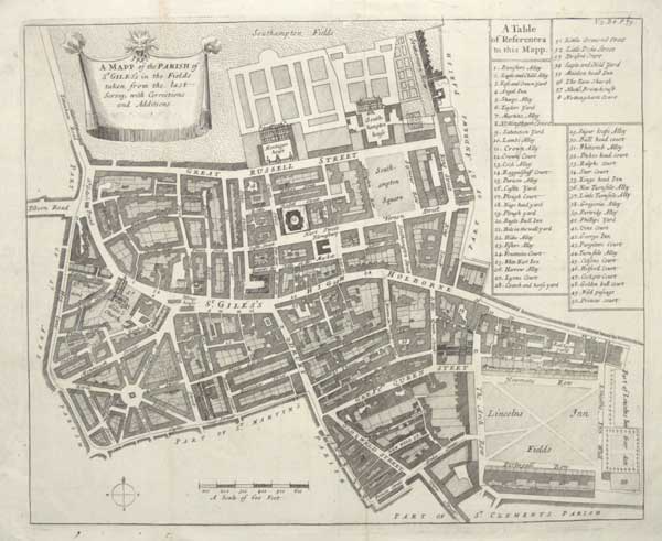
A Mapp of the Parish of St Giles's in the Fields taken from the last Survey with Corrections and Additions.
Engraved map. 330 x 370mm (13 x 14½"), very large margins. Folds and creases as normal. Small tear at bottom. A map of the parish of St Giles, covering the Seven Dials area of Covent Garden, Great Russell Street (with Montague house, now the British Museum), High Holborn, Great Queen Street and Lincoln's Inn Fields. Originally engraved for the 6th edition of Stow's 'Survey of London', 1720.
[Ref: 62465] £190.00