A View of London about the Year 1560. Reduced to this Size from a Large Print in the Collection of S.r Hans Sloane Bar.t anno 1738.
Etched map. Sheet 310 x 470mm (12¼ x 18½"). Trimmed within plate, binding folds as normal, stains. A map of Tudor London, based on the so-called 'Agas' woodcut map, showing St James's Park east to Whitechapel, with a 47-point key.
[Ref: 57269] £280.00
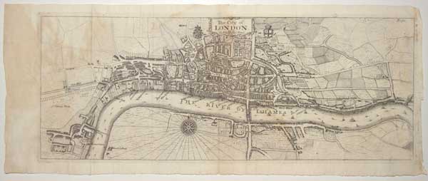
The City of London as in Q. Elizabeth's Time.
[n.d., 1720.] Etched map. 185 x 465mm (7¼ x 18¼"). Binding folds, a little staining. A map of Tudor London, published in 'Stow's Survey of London'. It is based on the so-called 'Agas' woodcut map, it shows St James's Park east to Whitechapel.
[Ref: 57268] £380.00