Results 1-4 of 4
<<< Previous 1 Next >>>
![Lough Belshade (Donegal) [pencil].](img-thumbnail/jpegs/49234.jpg)
Lough Belshade (Donegal) [pencil]. Just Published. Original Etching by A. Watson Turnbull. (Linited Editon).
A. Watson Turnbull [pencil].
[n.d., c.1930.]
Drypoint, signed by the artist, Fine Art Trade Guild blind stamps. 175 x 250mm (7 x 9¾") very large margins. In original mount with printed gallery label. Mint.
A lake in the Blue Stack Mountains of County Donegal in Ulster.
[Ref: 49234] £140.00
(£168.00 incl.VAT)
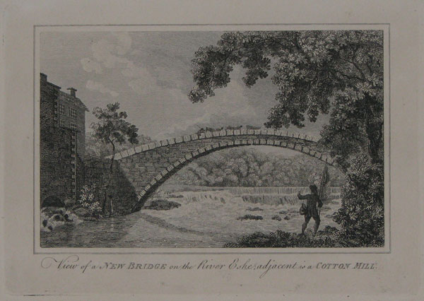
View of a New Bridge on the Rive Eske; adjacent is a Cotton Mill.
[n.d. c.1820.]
Engraving. Plate 140 x 196mm. 5½ x 7¾".
A view of a bridge over the River Eske, in County Donegal, Ireland. Sitll a favourite angling site on the outskirts of Donegal town.
[Ref: 22692] £45.00
(£54.00 incl.VAT)
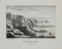
Chaussée des Geants. Giant's Causewary (Irlande).
Dess. et Lith. par Ed. de Montulé. Lith de Langlumé.
Lithograph. Sheet: 370 x 260mm (14½ x 10"). Very large margins.
A view of the basalt columns of the Giant's Causeway, in County Antrim in Northern Ireland. From 'Voyage en Angleterre et en Russie, pendent les années 1821, 1822 et 1823' by Edouard Montulé published in 1825 in which he described his travels to Great Britain and Eastern Europe.
[Ref: 39444] £130.00
(£156.00 incl.VAT)
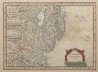
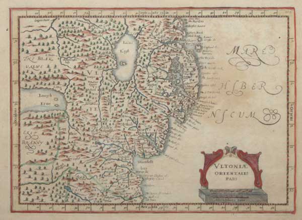
Ultoniae Orientalis Pars.
[engraved by Pieter van den Keere after Gerard Mercator.]
[Amsterdam: Jan Jansson van Waesberge, 1673.]
Engraved map with hand colour. 190 x 260mm (7½ x 10¼"), with large margins.
A map of eastern Ulster from Jan Cloppenburg's edition of the Mercator 'Atlas Minor', the largest of the pocket-size versions. First published in 1630 the plates were suppressed for many years before resurfacing for this last edition.
[Ref: 57716] £95.00
<<< Previous 1 Next >>>
![Lough Belshade (Donegal) [pencil].](jpegs/49234.jpg)