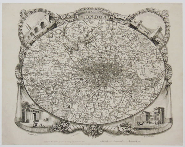
Environs of London.
Drawn and Engraved by James Bingley. Published Nov 3 1828 by Cowie & Strange, 64 Paternoster Row. Rare steel-engraved map. Sheet 210 x 270mm (8¼ x 10½"). Small repaired tear affecting publisher's inscription. An oval map of the environs of London, extending to Finchley in the north, clockwise to Tottenham, Barking, Woolwich, Norwood, Tooting, Wimbledon, Richmond, Brentford and Hendon. Within the decorative borders are vignette view of London Bridge, Hammersmith, Hyde Park Corner and the Post Office. At the bottom is the head of Old Father Thames and twin cornucopiæ (horns of plenty) filled with fruits and jewels representing the trade coming up the river. The design of this separate-issue map was later copied by Thomas Moule for his county atlas. Howgego No. 315.
[Ref: 37605] £280.00