Results 1-4 of 4
<<< Previous 1 Next >>>
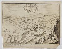
![[Battle of the Dunes, 1658.] Battaglia di Duncherchen.](img-thumbnail/jpegs/38455.jpg)
[Battle of the Dunes, 1658.] Battaglia di Duncherchen.
[Italy, c.1674.]
Rare engraved map. 300 x 370mm (30 x 14¼"). Made up bottom right corner, binding folds flattened.
A plan of The Battle of the Dunes, 14 June 1658, in which a Spanish army backed by English Royalists attempted to raise the siege of Spanish-held Dunkirk by a French army backed by English Parliamentarians. On the map 'z' marks the troops of James, Duke of York. A Parliamentarian fleet can be seen off the coast. The Spanish/English were repelled and Dunkirk fell ten days later, with a Parliamentarian garrison taking control. The map was published in one of the military histories of Galeazzo Gualdo Priorato (1606-78), an Italian professional soldier who fought in the Thirty Years' War.
[Ref: 38455] £180.00
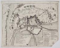
![[Battle of Lund.]](img-thumbnail/jpegs/38552.jpg)
[Battle of Lund.] Abris und vorstellung, der Merkwürdigen Haupt-Schlacht zwischen ihren Königlichen Majesteten: Herren Carolo XI. in Schweden, und Herren Christiano V. in Dännemark: beÿ Londen in Schonen den 4 Decemb: Anno. 1676. ergage.
[Engraved by Boutatts? after Galeazzo Gualdo Priorato]
[Vienna, c.1672.]
Rare engraved map. Sheet 340 x 430mm (13¼ x 17"). Tear into image bottom centre; Edges chipped, binding folds.
The Battle of Lund (4th December 1676), fought between the Danish army of King Christian V and the Swedish under Charles XI as part of the Scanian War (1675-9). Although a decisive Swedish victory the battle crippled both sides. The casualty rate was high: the Danish dead numbered 6,000 out of 13,000, the Swedish nearly 3,000 of 8,000, one of the highest percentages of any European battle in history.
[Ref: 38552] £230.00
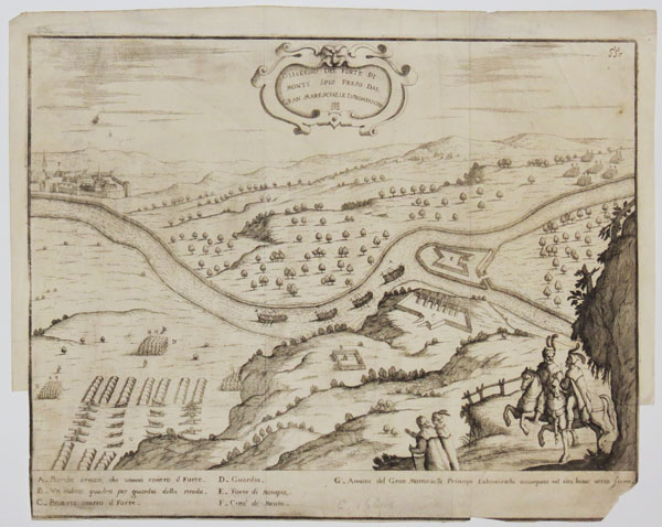
Dissegno del Forte di Monte Spiz Preso Dal Gran Marescialle Lubomirschi.
[Vienna, c.1672.]
Rare engraved map. 310 x 385mm (12¼ x 15¼"). Margins trimmed for binding, bottom right corner torn off.
A plan of the capture of the island fort 'Monte Spiz' ('Monspiz' in the key) by the Polish nobleman Jerzy Sebastian Lubomirski (1616-67). Although we cannot identify the place, it is likely to be one of the battles of 'Lubomirski's Rebellion' (1665-6), in which he forced King John II Casimir to give up his attempted political reforms. The map was published in one of the military histories of Galeazzo Gualdo Priorato (1606-78), an Italian professional soldier who fought in the Thirty Years' War.
[Ref: 38551] £190.00
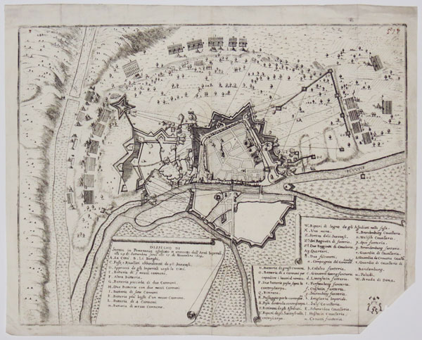
Dissengno di Stettin in Pomerania addediato et attaccatto dall'Armi Imperiali alli 29 di Settembre sino alli 15 di Novembre 1659.
[Vienna, c.1672.]
Rare engraved map. 310 x 390mm (12¼ x 15¼"). Lacking bottom corner, old ink numeral top right.
The Polish city of Stettin (Szczecin), then under Swedish rule, under siege by the Austrians. The map was published in one of the military histories of Galeazzo Gualdo Priorato (1606-78), an Italian professional soldier who fought in the Thirty Years' War.
[Ref: 38454] £140.00
<<< Previous 1 Next >>>
![[Battle of the Dunes, 1658.] Battaglia di Duncherchen.](jpegs/38455.jpg)
![[Battle of Lund.]](jpegs/38552.jpg)