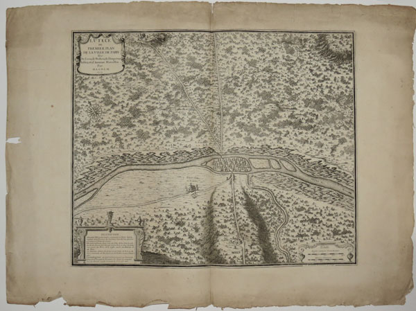
Lutece ou premier plan de la ville de Paris tiré de Cesar, de Strabon, de l'Empereur Julien et d'Ammiam Marcellin. Par M.L.C.D.L.M. 1705.
A. Coquart delineavit et sculp. [Paris: le Rouge, 1750?] Engraved map. 450 x 550mm, 17½ x 21¾" Tear in large margin, some surface soiling. Map of the environs of the ancient Gallic town of Lutece, which developed into the French capital Paris. The map shows the settlement as being entirely on the Île de la Cité, a long-held theory that is now being called into question, as archeological finds show as large pre-Roman settlement in the suburb of Nanterre. On the mainland, south of Lutece, are two temples, dedicated to Isis and Mercury: it is said that 'Paris' is derived from 'Per Isis' (i.e. near the temple of Isis). The church of Saint-Sulpice was built on the site in 1646.
[Ref: 25763] £420.00