
Vue De L'Anse Fermee De L'Entrée Du Prince Guillaume A La Cote N.O. De L'Amerique. Du Voyage de Cook, autour du monde, en 1772.
[Unidentified monogram] del. Garreau Sculp.
A Paris, chez Noel, Md. D'Estampes, Rue St. Jacques, No.38. et chez Bulla, Rue St. Jacques, No.38 [n.d. c.1790].
Engraving. 190 x 230mm. Light foxing.
Prince William Sound, on the south coast of Alaska. '3' inscribed upper right.
[Ref: 2645] £140.00
(£168.00 incl.VAT)

A View in Goulding's Harbour, North West Coast of America.
Publish'd May 1, 1789 by J. Stockdale & G. Goulding.
Engraving with very large margins. 185 x 235mm (7¼ x 9").
A view of a very rudimentary settlement at Goulding's Harbour, a side channel of Portlocks Harbor between Sitka and Juneau in Alaska. From George Dixon's 'Voyage round the World; but More Particularly to the North-West Coast of America: Performed in 1785, 1786, 1787, and 1788, in the King George and Queen Charlotte, Captains Portlock and Dixon'. This was the account of the first commercial voyage to the Pacific Northwest, attempting to trade sea-otter fur. The crew were the first English visitors to Hawaii since Cook.
[Ref: 35849] £190.00
(£228.00 incl.VAT)

nots D'Oonalashka.
Bénard direxit. [n.d. c.1785.]
Engraving. Collector's mark verso bottom right; 242 x 278mm (9½ x 11"). Trimmed.
Native of Unalaska, Alaska in canoes, from a French edition of James Cook's Third Voyage. Captain James Cook, explorer, cartographer and hydrographer went to command several notable voyages, the first was from 1768-1771. He was led to his commission by the direction of British overseas exploration in 1766 as commander of HM Endeavour for the first of three Pacific voyages. Cook's journals were published upon his return, and he became something of a hero among the scientific community. Cook's 12 years sailing around the Pacific Ocean contributed much to European knowledge of the area.
[Ref: 31089] £90.00
(£108.00 incl.VAT)
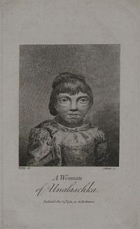
A Woman of Unalaschka.
W. Ellis del. J. Heath, sc.
Publish'd Decr. 14th 1781, by G. Robinson.
Copper engraving, 175 x 105mm. 7 x 4¼". A very fine impression.
A native of Alaska. From 'An authentic narrative of a voyage performed by Captain Cook and Captain Clerke, in His Majesty’s ships Resolution and Discovery during the years 1776, 1777, 1778, 1779 and 1780 : in search of a North-West passage between the continents of Asia and America…', by William Ellis, published 1782. Ellis was a surgeon's mate during Cook's third voyage, first on the Discovery and later on the Resolution, and gives quite a good history of this expedition. His account was published two years before the 'official' version. Ellis was also an amateur artist of some skill and the illustrations in the book are after his own drawings; they include eight of Hawaii, two of Alaska and three of the Northwest Coast.
[Ref: 13452] £90.00
(£108.00 incl.VAT)

Woman of the Aleutian Islands. Dr. Pritchard's Natural History of Man. Plate.
London, Published by H. Bailliere, 1842.
Coloured aquatint. 232 x 145mm (9¼ x 5¾").
A woman from the Aleutian Islands, which form part of the Aleutian Arc in the Northern Pacific Ocean. From 'Natural History of Man' by Dr James Cowles Pritchard.
[Ref: 30257] £80.00
(£96.00 incl.VAT)
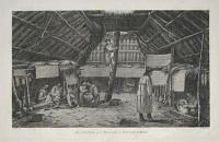
The Inside of a House, in Oonalashka.
J.Webber del. J.Hall & S.Middiman sc.
[London, G. Nicol and T. Cadell, 1785.]
Engraving. 260 x 415mm, 10¼ x x 16½". Large paper copy.
A scene on Unalaska, one of the Aleutian Islands off mainland Alaska. The natives are the Unangan, called the Aleut by Russian fur traders. John Webber (1751-93) travelled with Captain Cook on the Third Voyage (1776-80) as the Official Artist of the expedition, recording the explorer's death at the hand of Hawaiian natives.
[Ref: 11024] £130.00
(£156.00 incl.VAT)
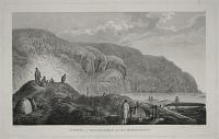
Natives of Oonalashka, and their Habitations.
J.Webber del. J.Hall & S.Middiman sc.
[London, G. Nicol and T. Cadell, 1785.]
Engraving. 260 x 415mm, 10¼ x x 16½". Large paper copy.
A scene on Unalaska, one of the Aleutian Islands off mainland Alaska. The natives are the Unangan, called the Aleut by Russian fur traders. John Webber (1751-93) travelled with Captain Cook on the Third Voyage (1776-80) as the Official Artist of the expedition, recording the explorer's death at the hand of Hawaiian natives.
[Ref: 11023] £180.00
(£216.00 incl.VAT)

A View in Coal Harbour in Cook's River.
J. Woodcock del. P Mazell Sculpt.
[London] Publish'd June 17, 1789, by J. Stockdale & G Goulding.
Rare etching, 180 x 230mm. 7 x 9". Large margins. Stitching holes to upper margin.
Nootka native North American canoes approach a three-masted ship, Coal Harbour (now Port Graham) Alaska. From Nathaniel Portlock's 'A Voyage round the World, but more particularly to the North-West Coast of America ... in 1785-1788'. University of Washington Libraries. BL 002963517.
[Ref: 20284] £160.00
(£192.00 incl.VAT)
![Inhabitants of Kotzebue Sound. [&] [Cadu.]](img-thumbnail/jpegs/44776.jpg)
Inhabitants of Kotzebue Sound. [&] [Cadu.]
[London: Richard Phillips, 1821.]
Coloured aquatints. Sheets 130 x 195mm (5 x 7¾") & 120 x 130mm (4¾ x 5¼"). Both trimmed, 'Cadu' losing title, mounted on album paper.
Two plates from the English edition of Otto von Kotzebue's 'Voyage of Discovery in the South Sea, and to Behring's Straits, in search of a North-east Passage; Undertaken in the Years 1815, 16, 17, and 18, in the Ship Rurick'. Kottzebue, named after the explorer, is in Alaska.
[Ref: 44776] £140.00
(£168.00 incl.VAT)
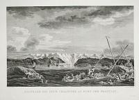
Naufrage des deux chaloupes, au Port des Francais.
Dessine par N. Ozanne. Gravé par Dequevauviller. L.Aubert scripsit.
[Paris: L'Imprimerie de la Republique, An V, 1797.]
Engraving. 390 x 560mm, 15½ x 22". Crease through middle of image.
Some of La Perouse's crew in trouble in the icy waters of Lituya Bay, Alaska (now part of the Glacier Bay Park & Wilderness), after the capsizing of two cutters, resulting in twenty-one deaths. In normal circumstances the waters are incredibly dangerous, with the spill of three glaciers entering the bay and a tidal difference of 10 feet; but in 1958 a megatsunami was recorded in the bay that destroyed trees to a height of 1,720 feet above sea-level, signifying a wave higher than the Empire State Building. In 1785 Jean-Francois de Galaup, comte de La Pérouse (1741-88) was sent by the French to continue Cook's exploration work in the Pacific, in the ships 'Astrolabe' & 'Boussole'. After three years, during which time he visited Chile, California, Alaska, Kamchatka, the Philippines, Japan and Hawaii, he travelled to Australia. Outside Botany Bay he met up with Captain Arthur Phillip's First Fleet, after which he set sail and was never seen again, despite an extensive rescue mission. Fortunately La Pérouse took every oportunity to send his work back to France: one crew member disembarked here at Petropavlovsk and spent a year crossing Russia back to France; later journals, charts and letters he left with the British at Botany Bay. Thus his discoveries were not lost with him, but published posthumously in this work, 'Voyage de la Perouse autour du monde..'.
[Ref: 45839] £520.00

Vue d'un Établissement des Habitans du Port des Francais pour la Saison de la Peche.
Dessiné par Blondela. Gravé par Le Grand. L. Aubert scripsit.
[Paris: L'Imprimerie de la Republique, An V, 1797.]
Engraving. 390 x 560mm, 15½ x 22". Crease through middle.
A temporary settlement in Lituya Bay, Alaska (now part of the Glacier Bay Park & Wilderness), used for the fishing season. In 1785 Jean-Francois de Galaup, comte de La Pérouse (1741-88) was sent by the French to continue Cook's exploration work in the Pacific, in the ships 'Astrolabe' & 'Boussole'. After three years, during which time he visited Chile, California, Alaska, Kamchatka, the Philippines, Japan and Hawaii, he travelled to Australia. Outside Botany Bay he met up with Captain Arthur Phillip's First Fleet, after which he set sail and was never seen again, despite an extensive rescue mission. Fortunately La Pérouse took every oportunity to send his work back to France: one crew member disembarked in Kamchatka and spent a year crossing Siberia back to France; later journals, charts and letters he left with the British at Botany Bay. Thus his discoveries were not lost with him, but published posthumously in this work, 'Voyage de la Perouse autour du monde..'.
[Ref: 18689] £360.00
![[Alaska] Inhabitants of Norton Sound, and their Habitations.](img-thumbnail/jpegs/34335.jpg)
[Alaska] Inhabitants of Norton Sound, and their Habitations.
J. Webber del. B. Pouncy sc.
[London: Nicol & Cadell, n.d., c.1785.]
Engraving with very large margins. On watermarked paper. Platemark: 250 x 395mm (9¾ x 15½"). Creasing in centre. Uncut.
A plate from 'Cook's Voyage to the Pacific'. An exterior view showing woman carrying a bucket with a child at her back, secured in cloth wrapped around her body, walking to right in the centre foreground. A man can be seen slightly behind, carrying a fish, with a log house partly covered with thatch behind them. A kayak is shown near the water in the right foreground, with hills and trees in the background and a glimpse of another bay to right. John Webber (1751-93) travelled with Captain Cook on the Third Voyage (1776-80) as the Official Artist of the expedition, recording the explorer's death at the hand of Hawaiian natives.
[Ref: 34335] £220.00
(£264.00 incl.VAT)
![[Alaska] Caps of the Natives of Oonalashka.](img-thumbnail/jpegs/34336.jpg)
[Alaska] Caps of the Natives of Oonalashka.
J. Webber del. J. Record sculp.t.
[London: Nicol & Cadell, n.d., c.1785.]
Engraving with large margins. Platemark: 280 x 205mm (11 x 8¼"). Uncut. Light creasing and staining.
A plate from 'Cook's Voyage to the Pacific'. Two detailed caps of the natives of Oonalashka, Alaska, both highly detailed in pattern, the upper decorated with feathers. John Webber (1751-93) travelled with Captain Cook on the Third Voyage (1776-80) as the Official Artist of the expedition, recording the explorer's death at the hand of Hawaiian natives.
[Ref: 34336] £90.00
(£108.00 incl.VAT)
![[Alaska] The Inside of of a House, in Oonalashka.](img-thumbnail/jpegs/34333.jpg)
[Alaska] The Inside of of a House, in Oonalashka.
J. Webber del. W. Sharp sculp.
[London: Nicol & Cadell, n.d., c.1785.]
Engraving with very large margins. On watermarked paper. Platemark: 255 x 400mm (10 x 15¾").
A plate from 'Cook's Voyage to the Pacific'. An interior view depicting a room with an apex roof built of logs and covered with thick fronds, with open sections in the top. A man can be seen climbing a tree-trunk in which steps have been cut, through one of the openings and families gathered under the eaves on either side, with household objects including baskets and woven cloths. John Webber (1751-93) travelled with Captain Cook on the Third Voyage (1776-80) as the Official Artist of the expedition, recording the explorer's death at the hand of Hawaiian natives.
[Ref: 34333] £180.00
(£216.00 incl.VAT)
![[Alaska] A Man of Oonalashka.](img-thumbnail/jpegs/51201.jpg)
[Alaska] A Man of Oonalashka.
J.Webber del. W.Sharp sc.
[London, G. Nicol and T. Cadell, 1785.]
Engraving. 285 x 220mm (11¼ x 8¾"). Trimmed to the plate.
An Unangan man, a native of Unalaska, one of the Aleutian Islands off mainland Alaska. Russian fur traders called his tribe the Aleut. John Webber (1751-93) travelled with Captain Cook on the Third Voyage (1776-80) as the Official Artist of the expedition, recording the explorer's death at the hand of Hawaiian natives. Most of the illustrations in the Official Account, 'A Voyage to the Pacific', were his.
[Ref: 51201] £140.00
(£168.00 incl.VAT)
![[Alaska] A Man of Prince William's Sound.](img-thumbnail/jpegs/34277.jpg)
[Alaska] A Man of Prince William's Sound.
J. Webber del. J. Bafire sc.
[London: Nicol & Cadell, n.d., c.1785.]
Engraving with very large margins. On watermarked paper. Platemark: 280 x 210mm (11 x 8¼"). Uncut, crease across middle.
A plate from 'Cook's Voyage to the Pacific'. A man, head and shoulders facing front and looking towards the viewer, wearing a fur cape and a patterned conical hat with a flattened top, tied under his chin. He has pendants hanging from his ears, with a nose ornament with beaded ends. James Cook entered Prince William Sound in 1778 and named it Sandwich Sound, after his patron the Earl of Sandwich. The editors of Cook's maps changed the name to Prince William Sound, in honor of Prince William, who would later become King William IV. John Webber (1751-93) travelled with Captain Cook on the Third Voyage (1776-80) as the Official Artist of the expedition, recording the explorer's death at the hand of Hawaiian natives.
[Ref: 34277] £120.00
(£144.00 incl.VAT)
![[Alaska] A Woman of Prince William's Sound.](img-thumbnail/jpegs/51199.jpg)
[Alaska] A Woman of Prince William's Sound.
J. Webber del. J. Basire sc.
[London: Nicol & Cadell, n.d., c.1785.]
Engraving., fine impression 310 x 240mm (12¼ x 9¾"). Trimmed to the plate. Slight crease in centre.
A woman, head and shoulders facing front and looking towards the viewer, wearing a fur cape tied under her chin. She has pendants hanging from her ears, with a nose ornament and piercings beneath her bottom lip. James Cook entered Prince William Sound in 1778 and named it Sandwich Sound, after his patron the Earl of Sandwich. The editors of Cook's maps changed the name to Prince William Sound, in honor of Prince William, who would later become King William IV. John Webber (1751-93) travelled with Captain Cook on the Third Voyage (1776-80) as the Official Artist of the expedition, recording the explorer's death at the hand of Hawaiian natives.
[Ref: 51199] £140.00
(£168.00 incl.VAT)

Snug Corner Cove.
Fittler sculp.
Published by Dr. Trusler June 1. 1790.
Engraving. 190 x 130mm (7½x 5"). Trimmed to platemark.
View of Snug Corner Cove, Alaska with canoes and figures.
[Ref: 32125] £90.00
(£108.00 incl.VAT)

N.º 2. Geological Plan & Section from the Rio Grand to the Pimas Villages. Along the Route explored by Leiut. John G. Parke, Corps of the Top.l Eng.rs. Near the Parallele of 32º North Latitude. 1856. Prepared to accompany the Report of Thomas Antisell M.D. Geologist of the Expedition.
U.S. Pacific Rail Road Expl. & Surveys War Department.
[Washington: Govenment Printing Office, 1861.]
Coloured lithograph. Sheet 385 x 640mm (15¼ x 25¼"). Original binding folds, crease in corner.
A geological map and cross section of the intended route of the first transcontinental railway in the U.S.A. The 'Pima' are the Akimel O'odham ('River Reople') of Arizona. Published in 'Reports of Explorations and Surveys, to Ascertain the most Practicable and Economical Route for a Railroad from the Mississippi River to the Pacific Ocean'.
[Ref: 62394] £180.00
(£216.00 incl.VAT)

Valley of the Gila & Sierra de Las Estrellas From Maricopa Wells. U.S.P.R.R. Exp. & Surveys 32º Parallel California. General Report Plate V.
A.H. Campbell.
[Washington: Govenment Printing Office, 1855.]
Tinted lithograph. Sheet 215 x 285mm (8½ x 11¼").
A view of the United States Pacific Rail Road surveyors' camp in a valley now occupied by the city of Phoenix, Arizona. Published in 'Reports of Explorations and Surveys, to Ascertain the most Practicable and Economical Route for a Railroad from the Mississippi River to the Pacific Ocean'. This was to the first transcontinental railway in the USA.
[Ref: 62387] £190.00
(£228.00 incl.VAT)
![[Arizona] View on the Gila Below the Great Bend.](img-thumbnail/jpegs/62450.jpg)
[Arizona] View on the Gila Below the Great Bend. U.S.P.R.R. Exp. & Surveys 32º Parallel & Cal. General Report Plate VI.
[Washington: Govenment Printing Office, 1855.]
Tinted lithograph. Sheet 215 x 285mm (8½ x 11¼").
A view of the Gila River with a wagon fording and people swimming. Published in 'Reports of Explorations and Surveys, to Ascertain the most Practicable and Economical Route for a Railroad from the Mississippi River to the Pacific Ocean'. This was to the first transcontinental railway in the USA.
[Ref: 62450] £120.00
(£144.00 incl.VAT)

N.º 1. Geological Plan of the Coastal Range of California from San Francisco Bay to Los Angeles. Along the Route explored by Leiut. John G. Parke, Corps of the Top.l Eng.rs to connect the Routes near the 35º & 32º parallels of North Latitude. 1855 & 1856. Prepared to accompany the Report of Thomas Antisell M.D. Geologist of the Expedition.
U.S. Pacific Rail Road Expl. & Surveys War Department.
[Washington: Govenment Printing Office, 1861.]
Coloured lithograph. Sheet 510 x 325mm (20 x 12¾"). Original binding folds, creased
A geological map of California, published in 'Reports of Explorations and Surveys, to Ascertain the most Practicable and Economical Route for a Railroad from the Mississippi River to the Pacific Ocean'.
[Ref: 62395] £180.00
(£216.00 incl.VAT)
![[Lassen County, California] Madelin Pass. June 19.th at 2 P.M. View from Mount Observation.](img-thumbnail/jpegs/62393.jpg)
[Lassen County, California] Madelin Pass. June 19.th at 2 P.M. View from Mount Observation. U.S.P.R.R. Exp. & Surveys 41.st Parallel. Expl. by Lieut. Beckwith. Vol II.
C. Schumann from F.W. Egloffstein. Selmar Siebert's Engraving & Printing Establishment, Washington, D.C.
[Washington: Govenment Printing Office, 1861.]
Engraving with hand colour. 260 x 795mm (10¼ x 31½"). Trimmed into plate one three sides, damage at original binding folds, tear taped.
An early view of the Madeline Plains, published in 'Reports of Explorations and Surveys, to Ascertain the most Practicable and Economical Route for a Railroad from the Mississippi River to the Pacific Ocean'. This was to the first transcontinental railway in the USA.
[Ref: 62393] £180.00
(£216.00 incl.VAT)
![[California] Northern Slopes of the Sierra Nevada. June 30.th at 9 A.M. View towards the West. 1854.](img-thumbnail/jpegs/62392.jpg)
[California] Northern Slopes of the Sierra Nevada. June 30.th at 9 A.M. View towards the West. 1854. U.S.P.R.R. Exp. & Surveys 41.st Parallel. Expl. by Lieut. Beckwith. Vol II.
C. Schumann from F.W. Egloffstein. Selmar Siebert's Engraving & Printing Establishment, Washington, D.C.
[Washington: Govenment Printing Office, 1861.]
Engraving with hand colour. 260 x 795mm (10¼ x 31½"). Trimmed into plate one three sides, damage at original binding folds, a few tears in lateral edges.
An early view of the Sierra Nevada, centred on the snow-covered volcano Mount Shasta. Published in 'Reports of Explorations and Surveys, to Ascertain the most Practicable and Economical Route for a Railroad from the Mississippi River to the Pacific Ocean'. This was to the first transcontinental railway in the USA.
[Ref: 62392] £180.00
(£216.00 incl.VAT)
![[California] Valley of the Mud Lakes Showing Eight Two Miles of the Projected Railroad Line June 14th at 9 A.M. From Mud Lake Peak. 1854](img-thumbnail/jpegs/62390.jpg)
[California] Valley of the Mud Lakes Showing Eight Two Miles of the Projected Railroad Line June 14th at 9 A.M. From Mud Lake Peak. 1854 U.S.P.R.R. Exp. & Surveys 32º Parallel. Expl. by Lieut. Beckwith. Vol II.
C. Schumann from F.W. Egloffstein. Selmar Siebert's Engraving & Printing Establishment, Washington, D.C.
[Washington: Govenment Printing Office, 1861.]
Engraving with hand colour. 260 x 785mm (10¼ x 31"). Trimmed to plate on three sides, original binding folds, two with splits taped.
An early view of the Valley of the Mud Lakes in the Sierra Nevada mountains, with a key including the entrance to Madelaine Pass, Mount Observation, Black Rock Range, and the Humboldt River Range. Published in 'Reports of Explorations and Surveys, to Ascertain the most Practicable and Economical Route for a Railroad from the Mississippi River to the Pacific Ocean'. This was to the first transcontinental railway in the USA.
[Ref: 62390] £180.00
(£216.00 incl.VAT)
![[California] Warners Pass from San Felipe.](img-thumbnail/jpegs/62388.jpg)
[California] Warners Pass from San Felipe. U.S.P.R.R. Exp. & Surveys 41.st Parallel. Expl. by Lieut. Beckwith. Vol II.
[Washington: Govenment Printing Office, 1855.]
Tinted lithograph. Sheet 215 x 285mm (8½ x 11¼").
A view of the United States Pacific Rail Road surveyors' camp in Warner's Pass, San Diego County, California. Published in 'Reports of Explorations and Surveys, to Ascertain the most Practicable and Economical Route for a Railroad from the Mississippi River to the Pacific Ocean'. This was to the first transcontinental railway in the USA.
[Ref: 62388] £85.00
(£102.00 incl.VAT)

Dress of the Inhabitants of California with their manners of Rafts for Fishing, &c.
Published by Alex.r Hogg No. 16 Paternoster Row London [n.d., 1778].
Engraving. 295 x 170mm (11½ x 6¾"), very large margins. Crease top margin.
From 'A New and Complete Collection of Voyages and Travels: Containing All that Have Been Remarkable from the Earliest Period to the Present Time', by John Hamilton Moore.
[Ref: 61403] £130.00
(£156.00 incl.VAT)

The Volcano Diggings.
Bayard Taylor. Lith. of Sarony & Major, N.Y.
[New York: George P. Putnam & London: Richard Bentley, 1850.]
Tinted lithograph. Sheet 140 x 190mm (5½ x 7½").
A view of a gold-miners' camp on Sutter Creek in Amador County, California. From ''Eldorado, or, Adventures in the Path of Empire: Comprising a Voyage to California, via Panama; Life in San Francisco and Monterey; Pictures of the Gold Region, and Experiences of Mexican Travel. By Bayard Taylor'', regarded as an important description of the Gold Rush.
[Ref: 52020] £160.00
(£192.00 incl.VAT)

San Francisco.
E. Hildebrandt. Chromofacsimile
[n.d. c.1865.]
Chromolithograph. 270 x 380mm. 10¾ x 15" Trimmed to image as normal.
A view up California Street, towards Nob Hill, one of the original 'Seven Hills' of the city. past Montgomery Street. On the right are the Parrott Building and St. Mary's, to the left Grace Church. In the foreground is a steam-powered trolley car, a decade before the introduction of the first cable system. Edward Hildebrandt (1818-1869) went on a world tour in the 1860s with stops that included the United States. A folio of his works from his round-the-world voyage were published as chromolithographs in 1864 in Berlin under the title 'Reise um die Erde' (Journey around the Earth). His original watercolours were exhibited in London in 1866 and Crystal Palace in 1868, just a year before his death in Berlin.
[Ref: 56145] £280.00
(£336.00 incl.VAT)

Vue du Presido S.n Francisco.
Lith de Langlumé r de l'Abbaye N4. Lith par V. Adam.
[n.d., c.1822.]
Lithograph. Sheet: 420 x 260mm (16½ x 10¼"), with large margins.
A view of the military fortress at San Francisco, showing Native Americans with packs on their backs being driven by mounted men. A plate from Louis Choris's 'Voyage Pictoresque Autour du Monde...' 1822, illustrating Choris's travels throughout America, Africa and Europe.
[Ref: 44587] £380.00

The Golden Gates. San Francisco.
[Edward Morrison de Courcy Short]
[1887]
Pencil sketch, 115 x 205mm. 4½ x 8".
A view of the Golden Gate strait connecting the Pacific Ocean with San Francsico bay, from an album of 'sketches made on a trip round the world'. By Edward Morrison de Courcy Short, b.1857, who attended Charterhouse School, Surrey (1870-6). He passed the Ceylon Civil Service exam in 1878, and in 1905 became Chairman of the Municipal Council and Mayor of Colombo, retiring in 1910. List of Carthusians, 1800-1879, by W.D. Parrish
[Ref: 11228] £150.00
(£180.00 incl.VAT)

San Francisco. Strasse in St. Francisco mit einem Dampf-Omnibus. [on publisher's label.]
[title label on verso:] Ed Hildebrandt. Chromofacsimilirt von R. Steinbock nach der Aquarelle aus der Sammlung "die Reise um die Erde".
[title label on verso:] Verlag von R. Wagner, Berlin, Zimmerstr. 92/93. [n.d. c.1865.]
Chromolithograph. 455 x 560mm. 18 x 22", laid on card as issued. Board soiled.
A view up California Street, towards Nob Hill, one of the original 'Seven Hills' of the city. past Montgomery Street. On the right are the Parrott Building and St. Mary's, to the left Grace Church. In the foreground is a steam-powered trolley car, a decade before the introduction of the first cable system. Edward Hildebrandt (1818-1869) went on a world tour in the 1860s with stops that included the United States. A folio of his works from his round-the-world voyage were published as chromolithographs in 1864 in Berlin under the title 'Reise um die Erde' (Journey around the Earth). His original watercolours were exhibited in London in 1866 and Crystal Palace in 1868, just a year before his death in Berlin.
[Ref: 22311] £380.00

San Francisco Highlands.
J.S. Foster.
Etching, signed in pencil, 12 x 8 ".
California School of Design in foreground.
[Ref: 2552] £220.00
(£264.00 incl.VAT)
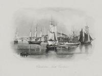
Charleston, South Carolina.
W.H. Brooke, F.S.A. T.A. Prior.
[n.d. c.1860.]
Engraving. Plate: 230 x 150mm, (9 x 6"). Small margins.
A view of Charleston, South Carolina, with various ships and paddle steamer seen in the harbour; St Michael's and St Philip's church spires can be seen behind. Engraved around the time of the American Civil War, in which the city played an important role.
[Ref: 39918] £75.00
(£90.00 incl.VAT)
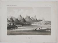
The Needles (Mojave Range). Colorado Exploring Expedition. Geology - Plate II.
J.J. Young from a sketch by H.B. Mollhausen. Lith. of Sarony, Major & Knapp, 449 Broadway, N.Y.
[Washington: Government Printing Office. 1861.]
Tinted lithograph. Printed area 165 x 220mm (6½ x 8¾"). Tears in inscription area.
A distinctive group of rock pinnacles above the Topock Gorge on the Colorado River, on the northwestern extreme of the Mohave Mountains. A band of native Americans are about to swin across the river. From the 'Report Upon The Colorado River of the West, Explored in 1857 and 1858 By Lieutenant Joseph C. Ives, Corps Of Topographical Engineers, Under The Direction Of The Office Of Explorations And Surveys, A.A. Humphreys, Captain Topographical Engineers, In Charge.'
[Ref: 39922] £75.00
(£90.00 incl.VAT)
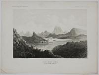
Cane Brake Cañon, From near Camp 16. Colorado Exploring Expedition. General Report - Plate II.
J.J. Young from a sketch by F.W. Eglofstein. Lith. of Sarony, Major & Knapp, 449 Broadway, N.Y.
[Washington: Government Printing Office. 1861.]
Tinted lithograph. Printed area 165 x 220mm (6½ x 8¾").
A view looking along the Colorado River, surrounded by towering rock formations, a steamer on the river, from a sketch by Baron Frederick W. von Eglofstein (1824-85), famed for being the first person to employ ruled glass screens, together with photography, to produce engravings, and his superbly accurate relief map of the Grand Canyon. From the 'Report Upon The Colorado River of the West, Explored in 1857 and 1858 By Lieutenant Joseph C. Ives, Corps Of Topographical Engineers, Under The Direction Of The Office Of Explorations And Surveys, A.A. Humphreys, Captain Topographical Engineers, In Charge.'
[Ref: 39913] £75.00
(£90.00 incl.VAT)
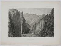
Mojave Cañon. Colorado Exploring Expedition. General Report - Plate III.
J.J. Young from a sketch by H.B. Mollhausen. Lith. of Sarony, Major & Knapp, 449 Broadway, N.Y.
[Washington: Government Printing Office. 1861.]
Tinted lithograph. Printed area 165 x 220mm (6½ x 8¾"). Tear in right margin.
A view looking along the Colorado River, with precipitous cliffs, a steamer on the river. From the 'Report Upon The Colorado River of the West, Explored in 1857 and 1858 By Lieutenant Joseph C. Ives, Corps Of Topographical Engineers, Under The Direction Of The Office Of Explorations And Surveys, A.A. Humphreys, Captain Topographical Engineers, In Charge.'
[Ref: 39917] £75.00
(£90.00 incl.VAT)
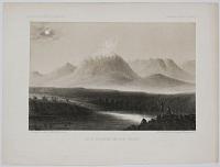
Dead Mountain, Mojave Valley. Colorado Exploring Expedition. General Report - Plate IV.
J.J. Young from a sketch by H.B. Mollhausen. Lith. of Sarony, Major & Knapp, 449 Broadway, N.Y.
[Washington: Government Printing Office. 1861.]
Tinted lithograph. Printed area 165 x 220mm (6½ x 8¾").
A snow-covered peak, apparently an invention of the artist, Balduin Möllhausen, as it resembles the view of Chimborazo by his hero Humboldt. Lieutenant Amiel W. Whipple, on whose 1853-4 expedition to plan an intercontinental railroad Möllhausen served, said that the only thing he painted accurately was a Navajo blanket. From the 'Report Upon The Colorado River of the West, Explored in 1857 and 1858 By Lieutenant Joseph C. Ives, Corps Of Topographical Engineers, Under The Direction Of The Office Of Explorations And Surveys, A.A. Humphreys, Captain Topographical Engineers, In Charge.' S.J. Pyne: How the Canyon Became Grand: A Short History.
[Ref: 39919] £75.00
(£90.00 incl.VAT)
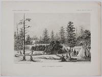
Camp - Colorado Plateau. Colorado Exploring Expedition. General Report - Plate VII.
J.J. Young from a sketch by H.B. Mollhausen. Lith. of Sarony, Major & Knapp, 449 Broadway, N.Y.
[Washington: Government Printing Office. 1861.]
Tinted lithograph. Printed area 165 x 220mm (6½ x 8¾").
A camp in a snow-covered clearing. From the 'Report Upon The Colorado River of the West, Explored in 1857 and 1858 By Lieutenant Joseph C. Ives, Corps Of Topographical Engineers, Under The Direction Of The Office Of Explorations And Surveys, A.A. Humphreys, Captain Topographical Engineers, In Charge.'
[Ref: 39921] £75.00
(£90.00 incl.VAT)
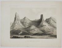
Shore on Lower Colorado. Colorado Exploring Expedition. Geology - Plate I.
J.J. Young from a sketch by H.B. Mollhausen. Lith. of Sarony, Major & Knapp, 449 Broadway, N.Y.
[Washington: Government Printing Office. 1861.]
Tinted lithograph. Printed area 165 x 220mm (6½ x 8¾") large margins.
A view from the Colorado River, looking up to towering rock formations. From the 'Report Upon The Colorado River of the West, Explored in 1857 and 1858 By Lieutenant Joseph C. Ives, Corps Of Topographical Engineers, Under The Direction Of The Office Of Explorations And Surveys, A.A. Humphreys, Captain Topographical Engineers, In Charge.'
[Ref: 39909] £75.00
(£90.00 incl.VAT)
![[Columbia University Campus, Morningside Heights.]](img-thumbnail/jpegs/50892.jpg)
[Columbia University Campus, Morningside Heights.]
Harry Fenn. [signed in pencil.]
1903. Copyright by M.R. Harder.
Rare etching, printed on chine collé and laid on board. Board: 440 x 620mm (17¼ x 24½''). Toning.
A view of the campus of Columbia University in New York shortly after its move to Upper Manhattan. The bird's-eye view shows the Low Memorial Library in the centre and in the foreground on the South Lawn figures play a game of baseball in front of a crowd. The original watercolour is housed in Columbia
[Ref: 50892] £550.00
![[Yale II.]](img-thumbnail/jpegs/45837.jpg)
[Yale II.]
E. Parsons.
[n.d. c. 1930.]
Etching. 175 x 240mm (6¾ x 9½"). Old crayon in margins.
Exterior view of Yale University, with people in the foreground.
[Ref: 45837] £70.00
(£84.00 incl.VAT)
![[Woolsey Hall, Yale.]](img-thumbnail/jpegs/45835.jpg)
[Woolsey Hall, Yale.]
E. Parsons.
[n.d. c. 1930.]
Etching. 250 x 200mm (9¾ x 8").
Exterior view of Yale University.
[Ref: 45835] £70.00
(£84.00 incl.VAT)

Brandford Court, Yale.
E. Parsons.
[n.d. c. 1930.]
Etching, 240 x 190mm (9½ x 7½") with large margins.
Yale University.
[Ref: 53604] £95.00
(£114.00 incl.VAT)
![[Yale - Harkness Dorm.]](img-thumbnail/jpegs/45833.jpg)
[Yale - Harkness Dorm.]
E. Parsons.
[n.d. c. 1930.]
Etching. 245 x 190mm (9¾ x 7¾").
Exterior view of Yale University, with church in background.
[Ref: 45833] £70.00
(£84.00 incl.VAT)
![[Little Tower - Yale.]](img-thumbnail/jpegs/45834.jpg)
[Little Tower - Yale.]
E. Parsons.
[n.d. c. 1930.]
Etching. 230 x 185mm (9 x 7¼").
Exterior view of Yale University.
[Ref: 45834] £70.00
(£84.00 incl.VAT)
![[Harkness Memorial Library. Yale.]](img-thumbnail/jpegs/45836.jpg)
[Harkness Memorial Library. Yale.]
E. Parsons.
[n.d. c. 1930.]
Etching. 230 x 180mm (9" x 7"). Tear and crayon in wide margins.
Yale University.
[Ref: 45836] £70.00
(£84.00 incl.VAT)
![[Cook Islands] A Man of Mangea.](img-thumbnail/jpegs/51200.jpg)
[Cook Islands] A Man of Mangea.
J. Webber del. W. Sharp sculp.
[London: Nicol & Cadell, n.d., c.1785.]
Engraving. 290 x 240mm (11½ x 9½"). Trimmed to the plate.
A man from Mangaia, Cook Islands, wearing a bone ornamental dagger through his ear and his hair tied up in a bun. John Webber (1751-93) travelled with Captain Cook on the Third Voyage (1776-80) as the Official Artist of the expedition, recording the explorer's death at the hand of Hawaiian natives.
[Ref: 51200] £95.00
(£114.00 incl.VAT)

Christiana Creek.
[Anon., British, n.d., c.1820s.]
Original pencil drawing, ruled border with pencil title below. Image 195 x 310mm, 7¾ x 12¼". Some handling marks to lower margin.
A sketch on the spot at Christiana, near Wilmington, Delaware, USA; moored ships and buildings on the riverfront. By a military or naval amateur draughtsman. One candidate is perhaps Frederick Fitzgerald De Roos (1804 - 1861), an officer in the Royal Navy who wrote 'Personal narrative of travels in the United States and Canada in 1826... With remarks on the present state of the American Navy', illustrated with plates after his drawings.
[Ref: 25130] £250.00
(£300.00 incl.VAT)

View of Durham Abbey, and adjoining Scenery, taken from the Banks.
G.B. Fisher Esq.r del.r. J.W. Edy fecit.
Pub'd Jan.y 1, 1798, by J.W. Edy, No.2, Romney Row, Westminster.
Scarce aquatint, printed in colours and hand finished. Visible area 540 x 720mm (21¼ x 28¼"). Mount pasted over edges, laid on board, some toning.
A large aquatint view showing Durham Abbey rising above the trees on the banks of the River Wear. The rare view was aquatinted by John William Edy after George Bulteel Fisher (1764-1834) who, having studied under Paul Sandby at the Royal Military Academy in Woolwich, continued to paint during his military career. As a young lieutenant he served as aide to Prince Edward Augustus (father of Queen Victoria), visiting Canada with him and publishing a rare series 'Six Views in North America' (also engraved by Edy) in 1795-6. The following year Fisher and Edy published six views of Gibraltar. The British Museum have both these sets but we have been unable to trace another example of this print of Durham.
[Ref: 49814] £450.00


![Inhabitants of Kotzebue Sound. [&] [Cadu.]](img-thumbnail/jpegs/44776.jpg)


![[Alaska] Inhabitants of Norton Sound, and their Habitations.](img-thumbnail/jpegs/34335.jpg)
![[Alaska] Caps of the Natives of Oonalashka.](img-thumbnail/jpegs/34336.jpg)
![[Alaska] The Inside of of a House, in Oonalashka.](img-thumbnail/jpegs/34333.jpg)
![[Alaska] A Man of Oonalashka.](img-thumbnail/jpegs/51201.jpg)
![[Alaska] A Man of Prince William's Sound.](img-thumbnail/jpegs/34277.jpg)
![[Alaska] A Woman of Prince William's Sound.](img-thumbnail/jpegs/51199.jpg)


![[Arizona] View on the Gila Below the Great Bend.](img-thumbnail/jpegs/62450.jpg)

![[Lassen County, California] Madelin Pass. June 19.th at 2 P.M. View from Mount Observation.](img-thumbnail/jpegs/62393.jpg)
![[California] Northern Slopes of the Sierra Nevada. June 30.th at 9 A.M. View towards the West. 1854.](img-thumbnail/jpegs/62392.jpg)
![[California] Valley of the Mud Lakes Showing Eight Two Miles of the Projected Railroad Line June 14th at 9 A.M. From Mud Lake Peak. 1854](img-thumbnail/jpegs/62390.jpg)
![[California] Warners Pass from San Felipe.](img-thumbnail/jpegs/62388.jpg)


![[Columbia University Campus, Morningside Heights.]](img-thumbnail/jpegs/50892.jpg)
![[Yale II.]](img-thumbnail/jpegs/45837.jpg)
![[Woolsey Hall, Yale.]](img-thumbnail/jpegs/45835.jpg)

![[Yale - Harkness Dorm.]](img-thumbnail/jpegs/45833.jpg)
![[Little Tower - Yale.]](img-thumbnail/jpegs/45834.jpg)
![[Harkness Memorial Library. Yale.]](img-thumbnail/jpegs/45836.jpg)
![[Cook Islands] A Man of Mangea.](img-thumbnail/jpegs/51200.jpg)

