
S.ir Jeffery Amherst, Knight of the most honorable Order of the Bath, Governor of Virginia, Colonel of His Majesty's 15.th & 60.th Regiments of Foot Lieutenant General, & Commander in Chief of His Majesty's Forces in North America from 1758 to 1764.
J. Reynolds pinx.t. R.P [within image]
[n.d. c.1766]
Fine mezzotint, plate 355 x 250mm (14 x 10"). With collectors stamp of Sir Thomas Lawrence (1769-1830) below artist. Unexamined outside of frame.
Three-quarter length portrait of Jeffrey Amherst, 1st Baron Amherst (1717-1797) resting his chin on his right hand, looking to left; wearing star and sash over armour, his helmet on plan of Montreal before him and landscape behind him. Amherst was an army officer and field marshal. Fought in North America 1758-61; governor of Virginia 1763. Hamilton: Pg2.
[Ref: 58984] £750.00
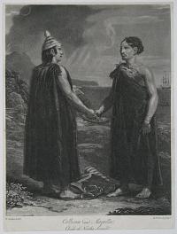
Callicum and Maquilla. Chiefs of Nootka Sound.
T.Stothard del. R.Pollard, sculp.t.
[n.d., c.1800.]
Rare aquatint. Sheet 270 x 205mm. Trimmed within plate.
From John Meares's 'Voyages Made in the Years 1788 and 1789 from China to the Northwest Coast of America'. Meares, a fur trader, caused an international incident by upsetting the Spanish who had already established a base at Nootka Sound, leading to George Vancouver's important expedition to the area.
[Ref: 11082] £280.00
(£336.00 incl.VAT)
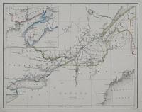
Canada
[Engraved by the Omnigraph F.P. Becker & co Patentees.]
[n.d., c. 1843.]
Engraved map with original hand colour. Sheet 210 x 270mm, 8¼ x 10½". Top edge with stitching damage.
Map of Canada, published in 'Becker's Omnigraph Atlas of Modern Geography'. The 'omnigraph' of Francis Paul Becker & Co. was a machine which produced an intaglio steel plate engraved with text and illustration.
[Ref: 13239] £65.00

Canada. Anfang des Rideau Canals bei Bÿtown am Ottawa.
[Leipzig: A. Weger, c.1850.]
Steel engraving. 280 x 320mm (11 x 12½").
A central scene of the Rideau Canal, Ottawa, surrounded by ten sketched scenes of Canada. The canal was built between 1826-32 to connect Montreal with the St Lawrence in case war with the United States cut the city's communications off. 'Bytown', the original name for Ottawa, comes from John By, a Colonel in the British Royal Engineers who supervised the building of the Canal
[Ref: 45628] £160.00
(£192.00 incl.VAT)

Bienfaisance d'une Famille Sauvage du Canada, envers des Français
J.M. Moreau le Jeane, Del. N. De Launay sculp. 1780.
[Geneva: Pellet, c.1780.]
Engraving with large margins. 280 x 215mm (11 x 8½").
'Charity of a savage family in Canada towards the French'. A plate from the Abbé Raynal's 'Histoire philosophique et politique des établissemens des Européens dans les deux Indes', a study of colonialism heavily influenced by the Englightenment, banned in his native France in 1779.
[Ref: 31842] £180.00
(£216.00 incl.VAT)
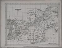
Canada.
Drawn & Engraved by Alex.r Findlay.
London. Published by Thomas Kelly, 17 Paternoster Row. [n.d., c.1840.]
Steel-engraved map. Sheet 210 x 270mm, 8¼ x 10½". Binding stitches in edge.
Map of Canada east of Lake Huron, showing south to New York City.
[Ref: 13233] £60.00
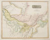
Canada and Nova Scotia.
Drawn and Engraved for Thomson's New General Atlas. [Edinburgh: John Thomson, c.1815.]
Engraved map with original hand colour. 530 x 650mm (20¾ x 25½"). Paper pasted around printed border at bottom to hide damp stains.
A map of the British Colonies in North America east of Lake Winnepeg, showing the Great Lakes.
[Ref: 43573] £360.00

Village of St. Hyacinthe. Co. of St. Hyacinthe.
R.S.M Bouchette Delt.
Day & Haghe, Lith.rs to the King 17 Gate St. Lin. Inn F.ds.
Rare lithograph. Sheet: 155 x 210mm (6 x 8¼''). Trimmed,
A view of the town of Saint-Hyacinthe in southwestern Canada after a drawing by Joseph Bouchette (1774-1841) who was a landowner and member of the militia who served as Canadian Surveyor-General of British North America. Abbey 622: Plate 10.
[Ref: 50018] £140.00
(£168.00 incl.VAT)

Sherbrooke, Eastern Townships, Lower Canada. Principal Station of the British American Land Company.
Day & Haghe Lith.rs to the King.
Rare lithograph. Sheet: 195 x 220mm (7¾ x 8¾''). Trimmed.
A view of Sherbrooke in Eastern Canada.
[Ref: 50023] £130.00
(£156.00 incl.VAT)

Woollen Factory, Sherbrooke, in the Eastern Townships, Lower Canada. Belonging to the British American Land Company.
Day & Haghe Lith.rs to the King.
Rare lithograph. Sheet: 195 x 220mm (7¾ x 8¾''). Trimmed.
A view of a large factory by the side of a waterfall in Canada.
[Ref: 50022] £180.00
(£216.00 incl.VAT)

Kilborn's Mills, Stanstead, L.r Canada & the United States Settlements, Verin! South of the Province Line_Late 45N.
On Stone by C. Haghe. Sketched by Col.n Bouchette.
W. Day Lith.rs to the King 17, Gate St. Lin. Inn F.ds.
Rare lithograph. Sheet: 165 x 240mm (6½ x 9½''). Trimmed
A view of a settlement in Canada after a drawing by Joseph Bouchette (1774-1841) who was a landowner and member of the militia who served as Canadian Surveyor-General of British North America. Abbey 622: Plate 13.
[Ref: 50019] £140.00
(£168.00 incl.VAT)

View in the Eastern Townships,_Lower Canada on the River St. Francis.
Day & Haghe Lith.rs to the King.
Rare lithograph. Sheet: 195 x 220mm (7¾ x 8¾''). Trimmed.
A view of a lake and farming settlements in Canada.
[Ref: 50021] £180.00
(£216.00 incl.VAT)

Views of the Principal Cities on the Line of the Grand Trunk Railway of Canada
By William Abbott, F.R.G.S. 10 Tokenhouse Yard, London, E.C.
[n.d., c.1880.]
Rare lithograph. Sheet 450 x 570mm (17¾ x 22½"). Splits in folds.
The eight views include Ottowa, Toronto, Montreal, Quebec, Portland and the ''International Bridge, Grand Trunk Railway of Canada, over Niagara River at Buffalo'', with a locomotive crossing.
[Ref: 56691] £360.00

Guelph. One of the Towns founded by Mr. Galt for the Canada Company in Upper Canada.
G. Chilas del.t. Engelmann & co. lith.
[n.d., c.1830.]
Lithograph, very scarce. Sheet size: 195 x 245mm (7¾ x 9½"). Cut to image on 3 sides. Crease down middle where bound. Top left corner missing.
A view of the town of Guelph, Canada, with a woman standing in the foreground, looking out towards the town, with a dog by her side. A bridge is seen across a river to the left, with various buildings distributed in the distance. Guelph was selected as the headquarters of British development firm 'the Canada Company' by its first superintendent John Galt, a popular Scottish novelist who designed the town to attract settlers to it and the surrounding countryside. Galt designed the town to resemble a European city centre, complete with squares, broad main streets and narrow side streets, resulting in a variety of block sizes and shapes. From Fraser's Magazine for Town and Country, volume 2, Nov. 1830.
[Ref: 36313] £190.00
(£228.00 incl.VAT)

Upper Chute South Falls Muskoka River.
E. Roper.
[n.d., c.1880]
Lithograph with very large margins. Rare; Sheet: 280 x 370mm, (11 x 17½").
A view of a waterfall in the Muskoka river in Ontario, Canada. Two figures can be seen crossing a bridge at the top of the waterfall while two figures sit on a fallen tree at the waterfall's base. Edward Roper (1832-1909) was an English artist who travelled around the world and made several trips to North America.
[Ref: 35052] £110.00
(£132.00 incl.VAT)
![[Loading timber onto a ship, Canada.]](img-thumbnail/jpegs/57354.jpg)
[Loading timber onto a ship, Canada.]
[n.d., c.1840.]
Tinted lithograph. Printed area 165 x 250mm (6½ x 9¾").
A sailing ship at a dock with a conveyor to load timber.
[Ref: 57354] £240.00
(£288.00 incl.VAT)
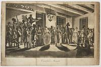
Canadian Minuets.
[Engraved by J.C. Stadler after George Heriot.]
[London Richard Phillips, 1808.]
Aquatint. 210 x 320mm (8¼ x 12½"). Folded twice, as issued, soiled.
A dance held in a rudimentary room, with both black and white musicians From George Heriot's 'Travels Through the Canadas', published as a part of Sir R. Phillips's eleven-volume ''A Collection of Modern and Contemporary Voyages and Travels'', 1805-10.
[Ref: 44741] £220.00
(£264.00 incl.VAT)
![Construction. [In pencil.]](img-thumbnail/jpegs/47062.jpg)
Construction. [In pencil.]
W.A. Howard. [Signed in pencil.]
[n.d., c.1930.]
Etching. Plate: 215 x 150mm (8½ x 6"), with very large margins. Cockling.
A view of a skyscraper being built.
[Ref: 47062] £260.00
(£312.00 incl.VAT)

Erie Basin.
White [?].
Etching, signed in pencil, 6.1/4" x 10".
[Ref: 6592] £100.00
(£120.00 incl.VAT)
![[Christ Church Cathedral] The Proposed Cathedral Church, Frederickton, New Brunswick,](img-thumbnail/jpegs/52546.jpg)
[Christ Church Cathedral] The Proposed Cathedral Church, Frederickton, New Brunswick, adapted from St Mary's, Snettisham, Norfolk.
Frank Wills, Architect, Exeter. R.K. Thomas lith. Day & Hague Lith.rs to the Queen.
[n.d., c.1840.]
Scarce tinted lithograph. Sheet 635 x 460mm (25 x 18¼"). very large margins.
The Gothic Revival Anglican Christ Church Cathedral, Fredericton, New Brunswick, begun 1845, consecrated 1853. When the diocese was established in 1845, John Medley was appointed as its first bishop. Before leaving England he chose a Norfolk church to base the design of the new cathedral on and hired the Exeter architect Frank Wills to make detailed plans which Medley took to Canada.
[Ref: 52546] £280.00
(£336.00 incl.VAT)

A View of the Bay of Gaspe in the Government of Quebec Situate in the Gulf of St. Laurence. A House on the Beach in which Gen.l Wolf resided in 1759. / 2. 1500 Quintals of Fish.
Gent. Mag. [Sylvanus Urban, pseudonym of publisher Edward Cave]
London, [n.d. 1764] [Edward Cave]
Engraving, 18th century watermark. 175 x 250mm (7 x 9¾"), with large margins. Two vertical creases as issued.
A view of Gaspe Bay, on the northeast coast of the Gaspe peninsula, Quebec. The General Wolf mentioned is British army officer James Wolfe (1727-1759), remembered for his victory over the French at the Battle of the Plains of Abraham in Quebec. The battle lasted only fifteen minutes but Wolfe was fatally shot three times; he was posthumously dubbed 'The Hero of Quebec'.
[Ref: 54089] £140.00
(£168.00 incl.VAT)

Entrance into Halifax Harbour.
D. Serres del. Wells Sculp.
by J. Gold, 703, Shoe Lane.
Aquatint. 140 x 230mm (5½ x 9¼"). Trimmed.
View of the harbour of Halifax, Nova Scotia. Published in the 'Naval Chronicle'.
[Ref: 53864] £130.00
(£156.00 incl.VAT)
![[Inhabitants of Hudson's Bay with their manner of killing Wild Fowl.]](img-thumbnail/jpegs/7124.jpg)
[Inhabitants of Hudson's Bay with their manner of killing Wild Fowl.]
[Amsterdam, Olfert Dapper, 1671.]
Engraving, 130 x 165mm, set in German text.
An Eskimo in a kayak. Published in Armold Montanus' 'America'.
[Ref: 7124] £90.00
(£108.00 incl.VAT)

Hurons.
Ansel delin.t. Fittler Sculp.
Published by J. Trusler. Sep.t. 1. 1790.
Engraving. 190 x 130mm (7½ x 5"). Trimmed.
American scene depicting the camp and some members of the Huron or Wyandot tribe, an indigenous people of North America.
[Ref: 32098] £130.00
(£156.00 incl.VAT)

A Hut on the West Coast of America, Lat. 65º 30 N.
W. Ellis del. W. Ellis dirext.
Published Decr. 14th. 1781. by G. Robinson.
Copper engraving, 125 x 160mm. 5 x 6¼". Lacking upper margin. A very fine impression.
A Native American structure. From 'An authentic narrative of a voyage performed by Captain Cook and Captain Clerke, in His Majesty’s ships Resolution and Discovery during the years 1776, 1777, 1778, 1779 and 1780 : in search of a North-West passage between the continents of Asia and America…', by William Ellis, published 1782. Ellis was a surgeon's mate during Cook's third voyage, first on the Discovery and later on the Resolution, and gives quite a good history of this expedition. His account was published two years before the 'official' version. Ellis was also an amateur artist of some skill and the illustrations in the book are after his own drawings; they include eight of Hawaii, two of Alaska and three of the Northwest Coast.
[Ref: 13448] £70.00
(£84.00 incl.VAT)
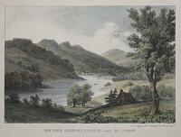
On the Kenibeckasis near St. John.
[Drawn by Bouchette.] Day & Haghe, Lith.rs to the King, 17 Gate St. Linc. Inn Fds.
[London: Longman, Rees, Orme, Brown, Green & Longman, 1832.]
Coloured lithograph, printed area 160 x 205mm.
From Bouchette's 'British Dominions in North America'. Abbey: Travel, 622.
[Ref: 731] £80.00
(£96.00 incl.VAT)

On Lake Muskoka.
E. Roper.
[n.d., c.1880].
Lithograph with large margins; rare. Sheet: 370 x 280mm, (14½ x 11). Crease in top right margin.
View across Lake Muskoka in which three figures hunt a swimming stag from a canoe. Edward Roper (1832-1909) was an English artist who travelled around the world and made several trips to North America.
[Ref: 35055] £160.00
(£192.00 incl.VAT)
![N.E. Cape of America and Part of Leopold Island. [&] Termination of the Cliffs Near Whaler P.t Port Leopold.](img-thumbnail/jpegs/46444.jpg)
N.E. Cape of America and Part of Leopold Island. [&] Termination of the Cliffs Near Whaler P.t Port Leopold. Dedicated by special permissions to The Lords Commissioners of the Admiralty By the Lordships most obedient Servant, W.H. Browne Lieu.t R.N. (late of H.M.S. Enterprise).
Lith.d by Cha.s Haghe, after the original by Lieu.t Browne. Printed by Da & Son.
London, Pub.d Jan.y 31.st 1850 by Ackermann & Co.96 Strand.
A pair of fine coloured lithographs on one sheet. Sheet: 385 x 285mm (15 x 11¼"), with large margins.
Two views of the Port Leopold was a trading post for the Hudsons Bay Company at Qikiqtaaluk Region of Nunavut Canada. Browne and his ship H.M.S. enterprise joined Sir James Clark Ross in his search for Sir John Franklin, 1848-1849. They wintered at Port Leopold on Somerset Island in Nunavut, Canada, visiting Prince Leopold Island nearby. Abbey: 637. From "Lt Browne Ten coloured views ..Artic Expedition of HMS Enterprise
[Ref: 46444] £280.00
(£336.00 incl.VAT)

Ice Castle, Montreal.
1881.
A very rare coloured lithograph, snow-effect glitter. 514 x 819mm. 20¼ x 32¼". Small tear into upper and lower edge; creasing to right. Cut to image.
In the 1880s, the Montreal Amateur Atheletic Association organised the famous annual Montreal Winter Carnival, which featured a temporary 'ice castle', which would be stormed in a mock attack.
[Ref: 25904] £480.00

Moos Hunter.
[after John Richard Coke Smyth]
[London: Thomas McLean, n.d., 1839.]
Tinted lithograph with hand colour. Sheet (almost) 280 x 400mm (11 x 15¾"). Trimmed within image top right, repaired tears, corners cracked with loss. Vry damaged.
A Native American hunter, with a dead moose, from 'Sketches in the Canadas'.
[Ref: 60920] £190.00
(£228.00 incl.VAT)
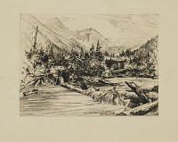
Mt. Sir Donald & Illecillewaet Glaceier, Selkirke, Canada
[Anon, c.1910]
Etching, platemark 140 x 190mm (5½ x 7½"). Rare.
View in the Selkirk Mountains, a mountain range spanning Idaho, Washington and southeastern British Columbia. They were named after Thomas Douglas, 5th Earl of Selkirk (1771-1820), a Scottish philanthropist who founded immigrant settlements in Canada. Mount Sir Donald is named after Donald Alexander Smith (1820-1914), head of the syndicate which funded the Canadian Pacific Railway.
[Ref: 39542] £220.00
(£264.00 incl.VAT)

Sketches on The Nipisaguit A River of New Brunswick B.N. America by William Hickman B.A. To His Excellency The Right Honorable The Earl of Mulgrave, Lieutenant-Governor of Nova Scotia, Etc. Etc. this work is respectfully dedicated, by his obediant humble servant. The Author.
W. Hickman, del. _ F. Jones, lith.
Halifax, N.S. Published by John B. Strong, Bookseller and Librarian. London: Day & Son, Lithographers to the Queen, Gate Street, Lincolns-Inn Fields. 1860.
Folio, original cloth, lettered in gilt with elaborate gilt design on cover. Eight coloured lithographic plates, as called for. Sheet size: 275 x 370mm (10¾ x 14½"), each wih letterpress description. Slight foxing throughout. Some staining to plates.
An illustrated account of self-taught amateur artist William Hickman's travels to the Nepisiguit River, New Brunswick, Canada, known at the time as 'the Rocky River' and famed for it's salmon fishing. This book was not originally intended for wider publication, but as 'mementos of a pleasant visit paid by the author, with a fishing-rod and sketchbook, to the banks of the Nipisaguit'. The titles of the plates are; 'No. 1. Above the Grand Falls', 'No. 2. The Grand Falls', 'No. 3. The Camp, Grand Falls', 'No. 4. Portage Below the Little Falls', 'No. 5. Morning at the Mid Landing', 'No. 6. The Pabineau Falls', 'No 7. Shooting A Rapid', 'No. 8. The Town of Bathurst'. Abbey: 629
[Ref: 37469] £2,000.00
view all images for this item

A View of the Entrance of S.t John's Newfoundland.
The Rev.d J. Hall del. J. Wells sculp.
Publish'd by Bunney & Gold, 1 July 1802.
Aquatint. Sheet: 140 x 250mm (5½ x 10''). Trimmed.
A view of the entrance to the harbour to St John's, capital of Newfoundland.
[Ref: 50028] £130.00
(£156.00 incl.VAT)

A View of a Stage & also of ye manner of Fishing for, Curing & Drying Cad at New Found Land.
[London: Herman Moll, c.1715.
Engraving. Sheet 175 x 210mm (6¾ x 8¼"). Trimmed from a larger sheet.
A view of the Newfoundland Cod Fishery, excised from Herman Moll's 'North America According to ye Newest and Most Exact Observations'.
[Ref: 61076] £230.00
(£276.00 incl.VAT)

Trinity Bay, Newfoundland. Exterior of Telegraph House, in 1857-1758.
[After Robert Dudley.]
Day & Son Limited, Gate Str. London, W.C. [1866.]
Coloured lithograph, trinted to image and laid on print card, as issued.
From William Howard Russell's 'The Atlantic Telegraph', the story of the first transatlantic cable, between Trinity Bay and Valentia in Ireland, in service for three months before snapping. 1st State.
[Ref: 1918] £80.00
(£96.00 incl.VAT)

Telegraph House, Trinity Bay, Newfoundland. Interior of 'Mess Room' 1858.
[After Robert Dudley.]
Day & Son Limited, Gate Str. London, W.C. [1866.]
Coloured lithograph, trinted to image and laid on print card, as issued. Small surface scuff.
From William Howard Russell's 'The Atlantic Telegraph', the story of the first transatlantic cable, between Trinity Bay and Valentia in Ireland, in service for three months before snapping. 1st State.
[Ref: 1919] £80.00
(£96.00 incl.VAT)
![[The Great Fall, Niagara.]](img-thumbnail/jpegs/39549.jpg)
[The Great Fall, Niagara.]
Mrs. Stenhouse, a memento of her old friend W. Forrest H.R.S.A. [In pencil below image to the right.]
Published by M. Knoedler & Co. New York. Entered according to Act of Congress in the year 1875, by M. Knoedler & Co. in the office of the Librarian at Washington.
Engraving on India paper. Printed area: 255 x 555mm (8¾ x 21¾"). Sheet size: 490 x 765mm (19¼ x 30") large margins. Nicks and creasing to margins. Tear in right margin that stops just outside of the plate.
View of Niagara Falls with a faint rainbow seen at left. A lighthouse and houses can be seen on the shore in the background. Dark clouds are in the sky to the right. After American painter Frederic Edwin Church (1826 - 1900), a central figure in the Hudson River School of American landscape painters,.
[Ref: 39549] £480.00

Inhabitants of Nootka Sound.
Jul. Ibbetson del.t. J. Hall direxit.
Published by D. Trusler June 1. 1790.
Engraving. 190 x 130mm (7½ x 5). Trimmed to platemark.
Scene depicting members of the Nootka, or Nuu-chah-nuth, peoples. The Nuu-chah-nuth are an indigenous people of the Pacific North West of Canada. When James Cook first encounted the Nuu-chah-nuth peoples in 1778, he mistook their order 'nuutkaa' (to circle around into the harbour) for the name of the harbour which is now known as Nootka Sound. The harbour is depicted in the image and a European ship can be seen in the distance.
[Ref: 32101] £130.00
(£156.00 incl.VAT)
![[Seal] A Sea Otter.](img-thumbnail/jpegs/34280.jpg)
[Seal] A Sea Otter.
J. Webber del. Mazell sc.
[London: Nicol & Cadell, n.d., c.1785.]
Engraving with very large margins. On watermarked paper. Platemark: 200 x 270mm (8 x 10½"). Uncut.
A plate from 'Cook's Voyage to the Pacific'. A reclining Nootka Sound sea otter on the shore with rocks and vegetationin the surrounding area. Nootka Sound is an inlet of the Pacific Ocean on the west coast of Vancouver Island, in the Canadian province of British Columbia. Historically also known as King George's Sound, as a strait it separates Vancouver Island and Nootka Island. John Webber (1751-93) travelled with Captain Cook on the Third Voyage (1776-80) as the Official Artist of the expedition, recording the explorer's death at the hand of Hawaiian natives.
[Ref: 34280] £160.00
(£192.00 incl.VAT)

A View of the Habitations of Nootka Sound.
J. Webber del. S. Smith sculp.
[London: Nicol & Cadell, n.d., c.1785.]
Engraving. Platemark: 255 x 400mm (10 x 15¾"). Trimmed to platemark at bottom. Small margins on 3 sides.
A view of the habitations of the natives of Nootka Sound. Low, broad buildings of slatted wood with flat roofs are constructed against and on top of dunes at the edge of the water, with frames for drying fish standing near them. Numerous figures are gathered on the shore in the foreground, mostly seated, receiving the Europeans with one in the shallows in the centre, bending over the contents of a laden canoe. Engraved by Samuel Smith for 'A Voyage to the Pacific Ocean' (1784), the official account of Captain Cook's Third and final voyage.
[Ref: 51219] £220.00
(£264.00 incl.VAT)
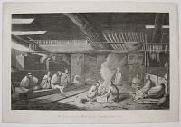
The Inside of a House in Nootka Sound.
J. Webber del. W. Sharp sc.
[London: Nicol & Cadell, n.d., c.1785.]
Engraving. 270 x 400mm (10½ x 15¾"). Trimmed to plate at the bottom.
An interior scene depicting a group of men and women, drying fish, baskets and chests, within a traditional communal house, with carved ornaments in the background. Engraved by William Sharp after John Webber for 'A Voyage to the Pacific Ocean' (1784), the official account of Captain Cook's Third and final voyage.
[Ref: 51211] £140.00
(£168.00 incl.VAT)

Vue des Habitations dfe L'Entrée de Nootka.
Benard direxit [after John Webber].
[Paris, 1785.]
Engraving. 245 x 375mm (9¾ x 14¾"). Trimmed close to the plate at the top. Folds as issued.
A view of the habitations of the natives of Nootka Sound. Low, broad buildings of slatted wood with flat roofs are constructed against and on top of dunes at the edge of the water, with frames for drying fish standing near them. Numerous figures are gathered on the shore in the foreground, mostly seated, receiving the Europeans with one in the shallows in the centre, bending over the contents of a laden canoe. Engraved by Robert Benard for the French edition of 'A Voyage to the Pacific Ocean' (1784), the official account of Captain Cook's Third and final voyage.
[Ref: 51226] £120.00
(£144.00 incl.VAT)

Vue de L'Interieur d'une Maison de L'Entrée de Nootka.
[after John Webber] Benard Direxit.
[Paris, 1785.]
Engraving. 270 x 400mm (10½ x 15¾"). Narrow margin at top. Repaired tear. Folds as issued.
An interior scene depicting a group of men and women, drying fish, baskets and chests, within a traditional communal house, with carved ornaments in the background. Engraved by Robert Benard after John Webber for the French edition of 'A Voyage to the Pacific Ocean' (1784), the official account of Captain Cook's Third and final voyage.
[Ref: 51225] £80.00
(£96.00 incl.VAT)

A Man of Nootka Sound.
J. Webber del. W. Sharp sculp.
[London: Nicol & Cadell, n.d., c.1785.]
Engraving, fine impression. 310 x 240mm (12¼ x 9½"). Trimmed to the plate.
A native of Nootka Sound, British Columbia. Directed to right, glancing towards the viewer, with tasselled threads in his hair. He has a nose ring and a grid pattern on his forehead. A plate from 'Cook's Voyage to the Pacific'. John Webber (1751-93) travelled with Captain Cook on the Third Voyage (1776-80) as the Official Artist of the expedition, recording the explorer's death at the hand of Hawaiian natives.
[Ref: 51197] £140.00
(£168.00 incl.VAT)

Flora Island, Lake Rosseau, from Oak Island (Dr. Hall's).
E.Roper.
[n.d., c.1883].
Lithograph with very large margins. Sheet: 370 x 280mm, (14½ x 11).
A view of Flora Island in Lake Rosseau in the Ontario area of Canada. A small sailing boat and some ducks can be seen on the water. Edward Roper (1832-1909) was an English artist who travelled around the world and made several trips to North America.
[Ref: 35063] £140.00
(£168.00 incl.VAT)

The Head of Lake Rosseau. Pratt's Just Before the Fire. 1883.
E. Roper.
Lithograph with very large margins; rare. Sheet: 370 x 280mm, (14½ x 11)"/ Large margins. Crease across top left corner.
View across Lake Rosseau. Two figures fish in the foreground while a steam boat sails across the river, a large house can be seen on the far side of the lake. . Edward Roper (1832-1909) was an English artist who travelled around the world and made several trips to North America.
[Ref: 35054] £140.00
(£168.00 incl.VAT)

At Port Carling, behind Stratton Hotel.
E. Roper
[n.d., c.1883].
Lithograph with very large margins. Sheet: 370 x 280mm, (14½ x 11). Some creasing in corners. Small tears in edges.
View of the lake at Port Carling in Ontario, Canada. Several small boats can be seen sailing on the lake. Edward Roper (1832-1909) was an English artist who travelled around the world and made several trips to North America.
[Ref: 35062] £160.00
(£192.00 incl.VAT)
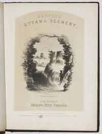
Hunter's Ottawa Scenery, in the vicinity of Ottowa City, Canada.
Lithographed by J.H. Burford Boston. [Plates drawn on Winslow Homer and John Perry Newell after drawings by William Stuart Hunter.]
Published by W.m S. Hunter Jr. Ottowa City Canada West, 1855. Entered according to act of Congress in the year 1855 by W.S. Hunter Jr. in the Clerks office of the district court of Mass.
Book. First edition. 14 lithograph plates, with folding map. Small folio, cloth binding, 260 x 345mm (10¼ x 13½"). Front board loose. Paper toning and foxing. Boards rubbed.
A series of fourteen plates depicting views around Ottawa with explanatory text and a folding map of the are. The plates include views of Rideau Falls, Views from Barrack Hill, Chaudiere Falls etc. Some plates such as 'View of Locks' drawn on stone by well-known American artist Winslow Homer (1836-1910), his work in this series was his earliest illustration work.
[Ref: 42430] £1,300.00
view all images for this item

Lake Rosseau from Pratt's Balcony in 1883.
E. Roper 1883.
Lithograph with very large margins; rare. Sheet: 370 x 280mm, (14½ x 11"). Some repaired tears in edges. Damage to top left corner.
View across Lake Rosseau in Canada from a balcony, small sailing boats can be seen on the lake while figures walk along the edge. Edward Roper (1832-1909) was an English artist who travelled around the world and made several trips to North America.
[Ref: 35053] £140.00
(£168.00 incl.VAT)

A Map of the Island of St John Near Nova Scotia lately taken from the French, 1758.
[London: R. Griffiths & J. Hoey, c.1758.]
Engraved map. 130 x 200mm (5 x 8") Trimmed into plate top.
A rare plan of Prince Edward Island, published in 'The Grand Magazine of Universal Intelligence and Monthly Chronicle of Our Times' during the French and Indian Wars. It illustrated an account of the Ile Saint-Jean Campaign, the part of the 'Expulsion of the Acadians', the French-speaking residents of P.E.I., Nova Scotia and Cape Breton/ The 'Grand Magazine' only lasted from July 1758 to November 1759.
[Ref: 55189] £140.00


![[Loading timber onto a ship, Canada.]](img-thumbnail/jpegs/57354.jpg)

![Construction. [In pencil.]](img-thumbnail/jpegs/47062.jpg)

![[Christ Church Cathedral] The Proposed Cathedral Church, Frederickton, New Brunswick,](img-thumbnail/jpegs/52546.jpg)


![[Inhabitants of Hudson's Bay with their manner of killing Wild Fowl.]](img-thumbnail/jpegs/7124.jpg)


![N.E. Cape of America and Part of Leopold Island. [&] Termination of the Cliffs Near Whaler P.t Port Leopold.](img-thumbnail/jpegs/46444.jpg)


![[The Great Fall, Niagara.]](img-thumbnail/jpegs/39549.jpg)

![[Seal] A Sea Otter.](img-thumbnail/jpegs/34280.jpg)


