Results 1-7 of 7
<<< Previous 1 Next >>>
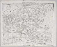
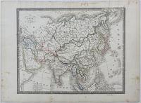
Carte d'Asie 1833.
[Paris c.1833.]
Engraved map. 200 x 240mm, 8 x 9½".
French map of Asia.
[Ref: 13241] £95.00
Asia, from the Modern Travellers, and most recent Works.
Printed by R. Juigné, 17, Margaret-street, Cavendish-square. [n.d., c.1817.]
Hand coloured engraving with surrounding letter press text and large margins. Sheet size: 495 x 715mm (19½ x 28¼").
A map of Asia, showing part of Australia, from Turkey and the Urals east to Kamchatka, surrounded by letterpress descriptions, published in an English edition of Le Sage's Historical Atlas.
[Ref: 37055] £420.00
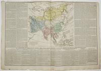
Asie Par C.V. Monin.
Paris, Hocquart, Editeur. [n.d., 1838.]
Engraved map with outline colour. 300 x 425mm (11¾ x 16¾"). Old ink mss in Russia and upper margin, laid on paper.
A general map of Asia, published in Monin's 'Atlas Classique de la Geographie Ancienne, du Moyen Age rt Moderne, a l'Usage des Colleges et des Pensions, Pour Servir a l'Etude de la Geographie et de L'Histoire'.
[Ref: 44000] £220.00
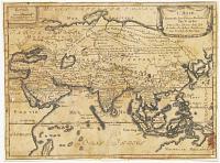
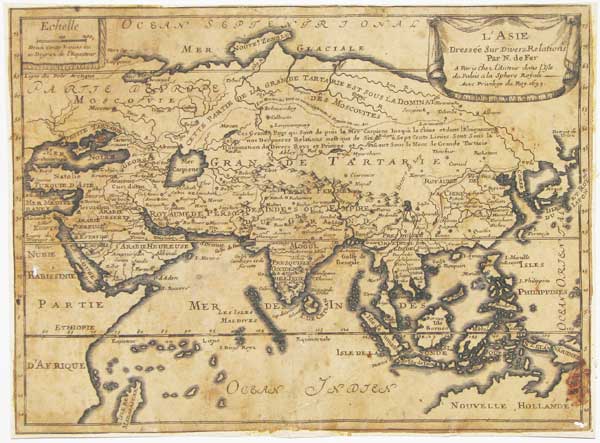
L'Asie Dressée sur Divers Relations.
Par N. de Fer, A Paris chez L'Auteur dans L'Isle du Palais a la Sphere Royale. Avec Privilege du Roy 1693. [but 1695.]
Engraved map. 210 x 280mm, 8¼ x 11". Trimmed, hole in bottom right corner, toned, rubbed, laid on card.
A uncommon map of Asia, published in the first edition of de Fer's Petite et Nouveau Atlas, with the Caspian Sea and Kamchatka yet to be mapped accurately. In the bottom right corner is part of Australia: when the map replaced soon after Australia was omitted and a new dedication was added top left.
[Ref: 17842] £220.00
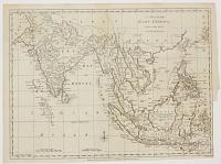
A Map of the East Indies, Drawn from the Best Authorities.
Jn.o Lodge sculp.
London, Published as the Act directs, 30th September 1780, by J. Bew, Pater Noster Row.
Engraved map. Sheet 285 x 390mm (11¼ x 15½"). Trimmed close to neatline lower right for binding, folds.
A map of the East Indies from India to the Philippines, published during the American War of Independence, Anglo-French War, Second AngloMysore War, and Fourth Anglo-Dutch War.
[Ref: 43276] £230.00
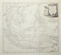
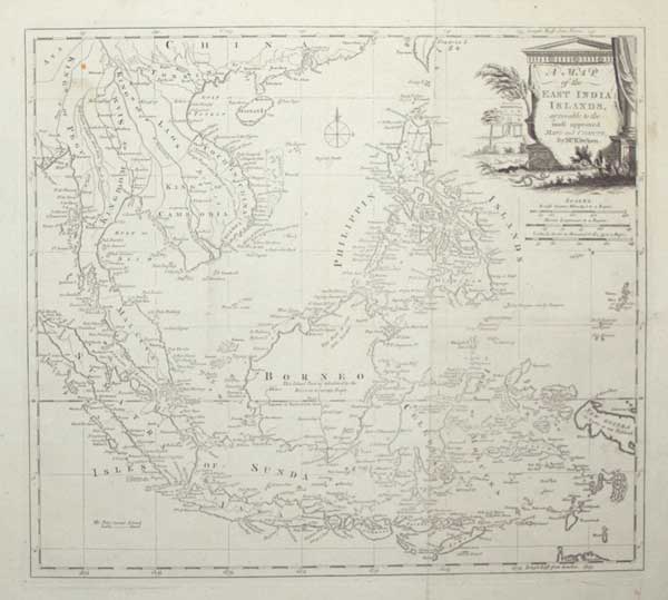
A Map of the East India Islands, agreeable to the most approved Maps and Charts, by Mr. Kitchin.
[engraved by Thomas Kitchin.]
[London, c.1785.]
Engraved map. 345 x 385mm (13½ x 15¼"), with very large margins. Original folds, some slight staining, some areas weakly inked.
A map of the East Indies, with the Malay Peninsula, Indochina, Indonesia and the Philippines. New Guinea has yet to be mapped properly. Originally published in 'Millar's New Complete & Universal System of Geography'.
[Ref: 55316] £250.00
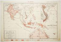
Map of South-Eastern Asia and Northern Australia. Showing The Districts in Annam and Tonquin which France proposes to annex and to place under a Protectorate, The portion of New Guinea proposed to be acquired by Queensland, And the Districts affected by the Volcanic Eruptions in Java.
Supplement to the Graphic, September 22.nd 1883.
Letts Son & Co. Limited London.
Map. Sheet: 420 x 620mm (16½ x 24½"). Cental crease as issued. Foxing.
A map of South East Asia, showing France's proposed annexation of Vietnam, completed the following year. It marks the colonies of the other European powers and shows the routes of the telegraph cables.
[Ref: 47050] £230.00
<<< Previous 1 Next >>>