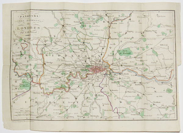
Panorama des Environs Londres, Par A.M. Perrot.
Gravé par Legagneur, Rue de la Harpe, No. 35. [n.d., but 1828.] Engraved map with original colour. Printed area 210 x 310mm (8¼ x 12"). Folded as issued. A tourist's map of the environs of London, extending from Windsor east to Gravesend and from Ware south to Reigate. From the 'Guide de l'Étranger a Londres'.
[Ref: 37603] £260.00
Panorama de Londres, Par A.M. Perrot.
Gravé par Legagneur, Rue de la Harpe, No. 35. [n.d., but 1828.] Engraved map with original colour. Sheet 355 x 450mm (14 x 17¾"). Folded as issued, trimmed to printed border on right. A tourist's map of London, showing only the major roads, extending from Hyde Park east to the East India Docks and from Kentish Town south to Kennington. From the 'Guide de l'Étranger a Londres'.
[Ref: 37602] £260.00