Results 1-2 of 2
<<< Previous 1 Next >>>
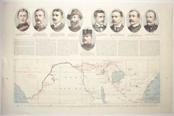
Mr. H.M. Stanley's Explorations in the Dark Continent - Map of the Route and A Portrait Group of the Officers of his Expedition. Sketch Map to Illustrate H.M. Stanley's Route in the Emin Relief Expedition.
Drawn by W. and A.K. Johnston, Edinburgh.
[London., 1890.]
Wood engraving, printed in colour. Sheet 390 x 600mm (15¾ x 23¾"). Some spotting. Central crease as normal. Repaired tears in central crease.
A map of central Africa and nine roundel portraits of members of Henry Morton Stanley expedition (1886-9) to relieve the governor of Equatoria (south Sudan) from Mahdist forces. Published in the Graphic Newspaper.
[Ref: 58150] £160.00
(£192.00 incl.VAT)
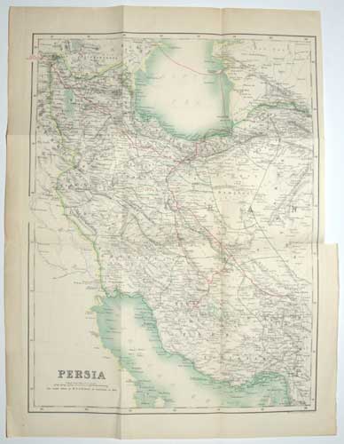
Persia. The route taken by M.r E.G. Browne is indicated in Red.
W. & A.K. Johnston, Edinburgh & London.
[Edinburgh: A. & C. Black, 1893.]
Lithographic map, printed in colours. Printed area 395 x 300mm (15½ x 11¾"). Repaired tear from original binding folds.
The general map from Edward Granville Browne's 'A Year Among the Persians', showing his route from Kurdinstan to Terhran, Shiraz and Kerman, and across the sea to Baku. Browne (1862-1926) was a British Iranologist who spent a year there in 1887-8. This account was very favourable towards the Persians, who reciprocated their feelings: a Tehran street named after him and a statue survived the Iranian Revolution in 1979.
[Ref: 57631] £130.00
<<< Previous 1 Next >>>